It was summer of 2000 when we started for the HemKund Sahib and Kagbhusundi Lake trek. Starting from Kanpur in the afternoon we reached Hardwar the next morning. The bus service for Badrinath is available from Rishikesh. So we reached the Tehri Bus stop in Rishikesh and boarded a bus for Badrinath. In general, people prefer to go directly to Badrinath or Joshimath taking the night halt midway, and reaching Badrinath the next morning. We had decided to take the night halt at Rudraprayag. It is one place I have started liking a lot.
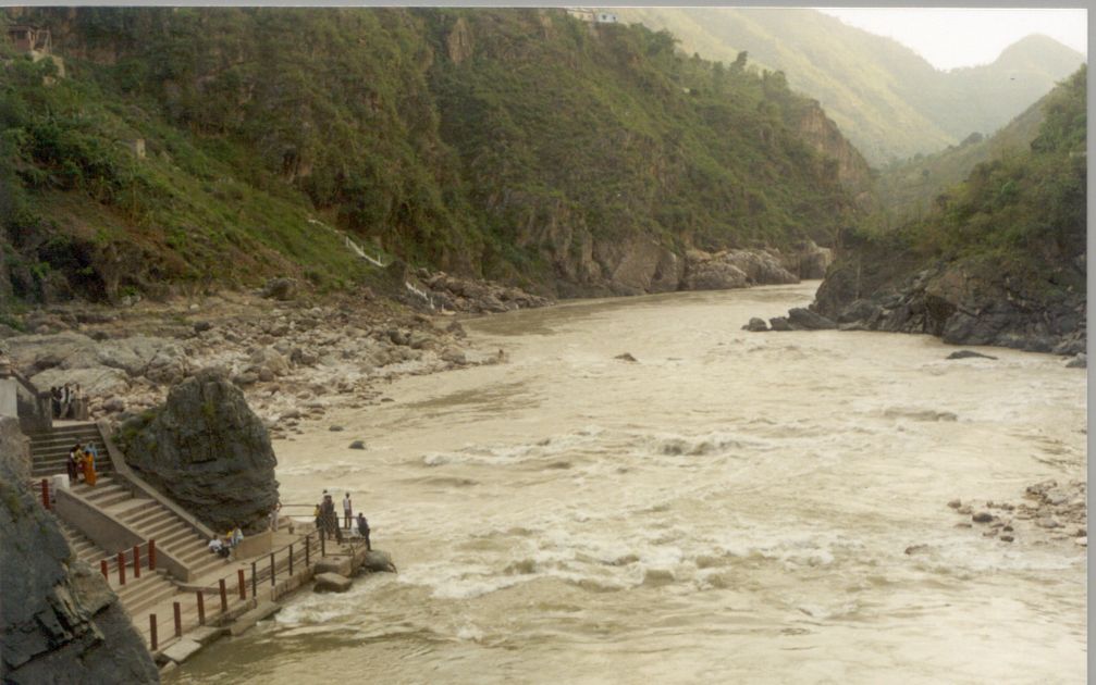
Rudraprayag is a small town on the confluence of river Alakhnanda and Mandakini. It is 139 kms from Rishikesh and has an altitude of 610 m above sea level. It has become a District Headquarters and lost a bit of it's serene beauty. And has also lost the beautifully located GMVN's Mandakini Rest house to District Magistrate, who is using it as his office. Rudraprayag is also famous because of Jim Corbet's "Man Eating Leopard of Rudraprayag".
It was almost 5 pm when we settled down in a lodge in Rudraprayag. It is
better to have your booking in advance. Garhwal Mandal Vikas Nigam Rest
 Houses are comfortable and one can find them in every major town on the
route. Earlier accommodation was always available in GMVN Rest Houses but
with some of them accommodating Govt. Offices and with more number of organized
tours, it is better to have your booking made in advance.
Houses are comfortable and one can find them in every major town on the
route. Earlier accommodation was always available in GMVN Rest Houses but
with some of them accommodating Govt. Offices and with more number of organized
tours, it is better to have your booking made in advance.
It is a pleasure taking bath in cold water of Mandakini, especially after having traveled for the whole day in the hot summer of June. Even Rudraprayag was relatively hot this summer. We spent our evening sitting on the banks of Mandakini and watching the rapids in the two rivers, Alakhnanda and Mandakini. When we reached our lodge, it had started drizzling. What we need was a hot dinner and a good rest.
Next morning we started for Badrinath. One doesn't have to go upto Badrinath
for Hemkund trek but we had planned things in such a way so as to visit
Badrinath and then start the trek from Govindghat in the morning. From
Rudraprayag there is a Bus Service which starts early in the morning. It
reaches Joshimath by 1:00 pm and Badrinath by 4:00 pm. The route to Badrinath
is along the river Alakhnanda. One comes across numerous Prayags (confluence
of two rivers). Some of the known ones are Karnprayag (meeting point of
Alakhnanda and Pindar), Nandprayag (Nandakini joins Alakhnanda here) and
 Vishnuprayag (near Joshimath, where Dhauli Ganga meets Alakhnanda).
Soon after Chamoli we got the first glimpse of snow covered peak. It was raining when we reached Badrinath. The peaks all round were covered with clouds and it was really cold. Badrinath is at a height of 3110 m and is 300 kms from Rishikesh. The abode of Lord Vishnu is famous for it's religious importance and has a temple dedicated to Vishnu, built by Adiguru Shankaracharya in the 8th century. We stayed in GMVN rest house. Though there is no shortage of accommodation in Badrinath, but things may turn bad on certain days, hence it is better to get the booking done in advance.
Next morning we left for Govindghat which is 30 kms from Badrinath. It had started raining in Badrinath and it was later that we came to know that ours was the last Bus to leave Badrinath for the next three days. Karnprayag to Badrinath route is highly vulnerable to landslides and it quite often gets blocked. Sometimes for hours and at times, even for days.
It was almost 9:00 am when we started trekking from Govindghat. Govindghat
is at an altitude of 1829 m and has a huge parking space for private cars.
One need not carry anything other than the clothes when going for Valley
of Flowers and Hemkund Sahib trek. But we were going for Kagbhusundi Lake
too and hence had to carry tents, food, etc. with us. Our destination for
 the day was Ghangaria which is 15 kms from Govindghat. The initial 3 kms
climb from Govindghat is slightly tough. Water is a major problem in this
route, especially for first 7 kms. One has to depend on roadside tea stalls
for water. It is better to carry your own water bottle.
the day was Ghangaria which is 15 kms from Govindghat. The initial 3 kms
climb from Govindghat is slightly tough. Water is a major problem in this
route, especially for first 7 kms. One has to depend on roadside tea stalls
for water. It is better to carry your own water bottle.
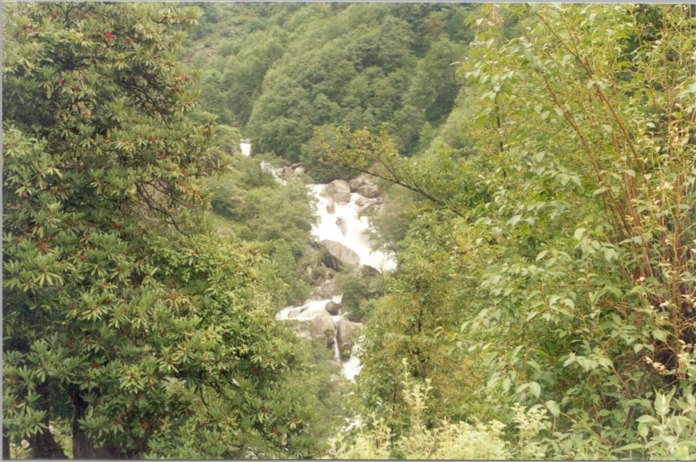
The route is beautiful but slightly overcrowded. Hemkund Sahib being one of the important pilgrimage for Sikhs all over the world. It is believed that Guru Govind Singh meditated on the bank of Hemkund Lake in one of his earlier births. The trekking season in this region starts in August. Even the Valley of Flowers route opens only in late June.
It started pouring when we had only covered 5 kms. The progress for next
 10 kms was slow and tiring. Though we had raincoats, still the water was
seeping through the seam. Our rucksacks were also getting drenched and
were feeling heavier. We crossed a small village called Bhiundhar. It is
5 kms from Ghagharia, and at an altitude of 2239 m. It is a starting point
for trek to Kagbhusandi Lake.
10 kms was slow and tiring. Though we had raincoats, still the water was
seeping through the seam. Our rucksacks were also getting drenched and
were feeling heavier. We crossed a small village called Bhiundhar. It is
5 kms from Ghagharia, and at an altitude of 2239 m. It is a starting point
for trek to Kagbhusandi Lake.
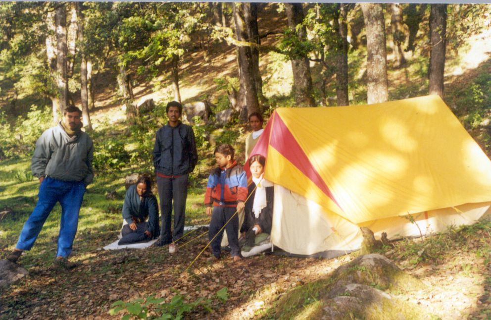
It was 5:00 pm when we reached Ghangaria. The last 5 kms from Bhiundhar to Ghangaria are slightly steep gaining an altitude of 800 m in 5 kms. Ghangaria is a small village with reasonable boarding and lodging facilities. Restaurants serving all kinds of food, cater to the needs of the tourists. We settled into the warmth of our room in a lodge. It had been a non-stop rain since morning and it was cold. Warm food was followed by the hot tea. After a tiring day of trek, it just required the warm comfort of our bed for everyone to pass into the deep sleep.
Next morning it was still raining and it required a bit of determination
on our part to force our tired souls to leave the warm comfort of our room.
It was 10:00 am when half of the team could muster the courage to start
for the Hemkund Sahib. It is a steep five kms uphill trek from Ghangaria
to the high-altitude Lokpal Lake in Hemkund Sahib. Starting at an altitude
 of 3048 m, the trek scales the side of the mountain to reach the ledge
at an altitude of 4329 m where Hemkund Sahib Gurdwara is situated.
of 3048 m, the trek scales the side of the mountain to reach the ledge
at an altitude of 4329 m where Hemkund Sahib Gurdwara is situated.
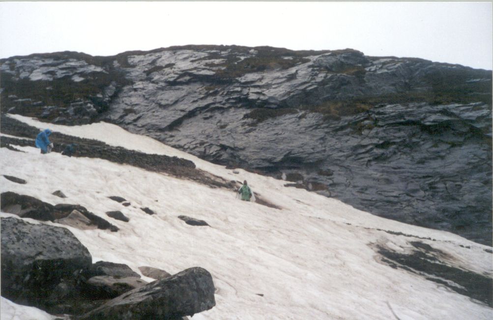
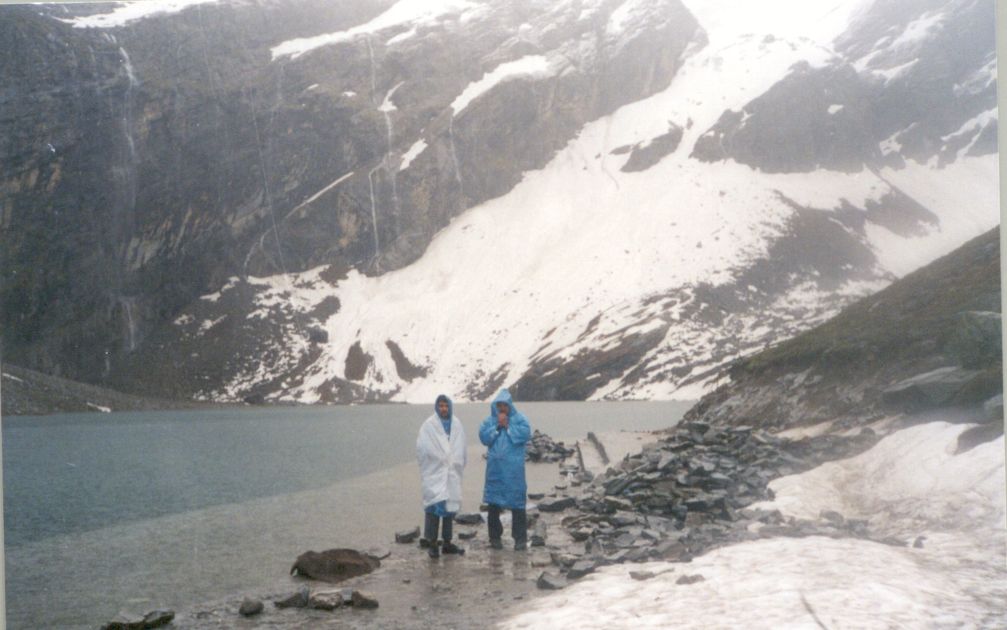
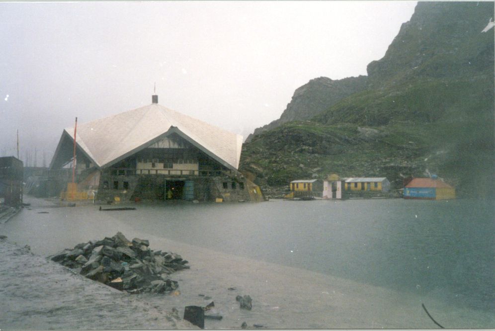
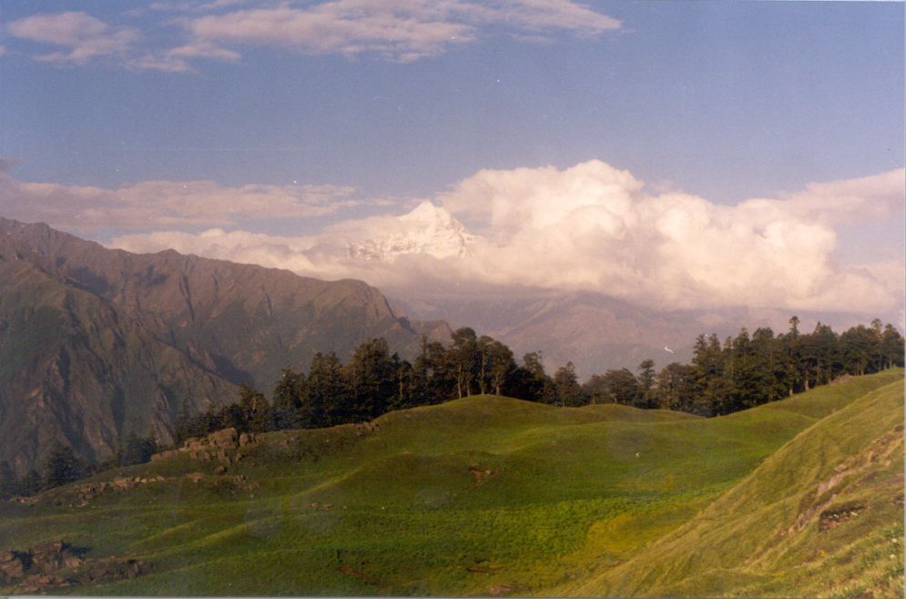
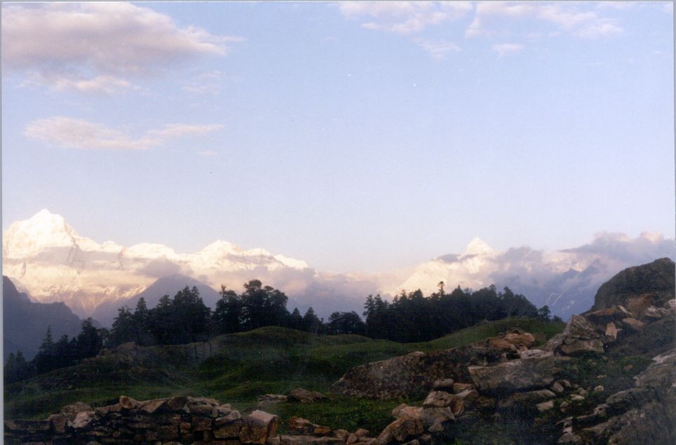
The paved trek was slippery due to rain and progress was slow. The lungs were feeling the strain because of the rarefied air. Enroute we crossed one glacier. After trekking for five hours, when we reached Hemkund Sahib at 3:00 pm, it was so cold that my hands were turning blue. But what we saw was something majestic. Encircled by seven snow-clad peaks and their associated glaciers, was a lake reflecting its surroundings enchantingly in its serene crystal-clear waters. The glaciers of Hathi Parbat and Sapt Shring peaks feed the lake and a small stream, the Him Ganga, flows from the lake. There is a Sikh Gurudwara and a Lakshman temple on the bank of the lake.
With snow all round us, and rain pouring down and little or no shelter
 from the wind, the temperature was going down every minute and we were
advised to hurry down. There is no accommodation at Hemkund Sahib. One
has to really experience the raw nature to realize the tough life of Himalayas.
from the wind, the temperature was going down every minute and we were
advised to hurry down. There is no accommodation at Hemkund Sahib. One
has to really experience the raw nature to realize the tough life of Himalayas.
Going down was easier and one had to just take care of avoiding a slip on the slippery path. When we reached Ghangaria at 5:30 pm, our clothes were wet and our bodies were shivering badly. It took few cups of tea and the warmth of the blankets and dry clothes, before our bodies stopped shivering. It had been two days of non-stop rains, and things looked gloomy for the next stage of our trek to Kagbhusandi lake.
It was a warm sunshine that greeted us the next morning . It brought in
lot of warmth and joy for the team. After what we had seen in Hemkund Sahib,
 it was decided that the rest of the team should also visit the lake and
experience the joy of seeing one of the most beautiful high-altitude lake
in Garhwal Himalayas. While the other members were gone for Hemkund Sahib,
we decided to explore the Valley of Flowers route. The Valley of Flowers
was not yet open. The trek is along the river Pushpavati. It is the same
river along which we had been trekking from Govindghat. We trekked for
a km or so, crossed a glacier, wandered in the forest and returned back
to wait for the team that had gone to Hemkund.
it was decided that the rest of the team should also visit the lake and
experience the joy of seeing one of the most beautiful high-altitude lake
in Garhwal Himalayas. While the other members were gone for Hemkund Sahib,
we decided to explore the Valley of Flowers route. The Valley of Flowers
was not yet open. The trek is along the river Pushpavati. It is the same
river along which we had been trekking from Govindghat. We trekked for
a km or so, crossed a glacier, wandered in the forest and returned back
to wait for the team that had gone to Hemkund.
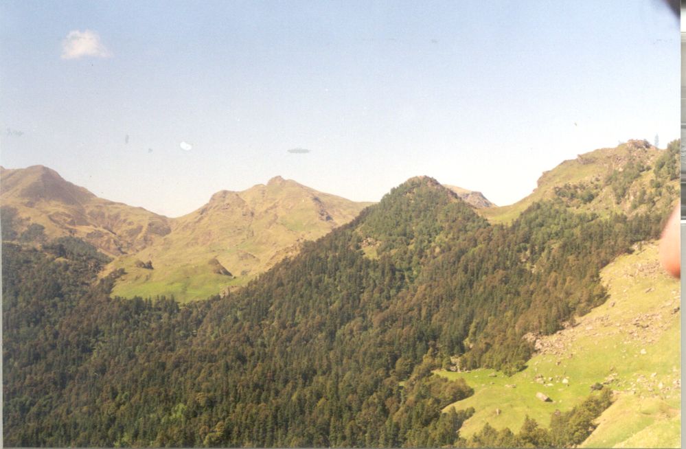
Valley of Flowers is 10 kms long and 2 kms wide and is in a conical shape. It requires a trek of 5 kms to reach the edge of the valley. The valley ranges between 3352 and 3658 m, in altitude. One can trek westwards about 12 kms and reach the motor road near Hanuman Chatti by crossing the Khunt Khal (pass 4572 m). More adventerous route is via Bhiundhar Pass (above 5000 m) to reach Ghamsali and Niti. This 25 kms high-altitude trek provides a ringside view of a dozen snow peaks including Rataban, Hathi Parbat, Lampak, Kamet, Mana, Mukut Parbat etc. The snows, the floral beauty, and the entire environment are divine.
Around 2:00 pm we started for Bhiundhar. The plan was that we will settle
 down at Bhiundhar Village. Some of us would trek to Kagbhusandi Lake while
rest were to stay in Bhiundhar and spend the next three days trekking in
the forests around. But all our plans were to go in disarray on reaching
Bhiundhar Village. The trekking season starts late and most of the villagers
were still in Joshimath. There were no guides or porters available. We
should have hired some from Joshimath itself. Secondly there is no accommodation
in Bhiundhar. We should have allowed the team staying back to stay in Ghangaria.
down at Bhiundhar Village. Some of us would trek to Kagbhusandi Lake while
rest were to stay in Bhiundhar and spend the next three days trekking in
the forests around. But all our plans were to go in disarray on reaching
Bhiundhar Village. The trekking season starts late and most of the villagers
were still in Joshimath. There were no guides or porters available. We
should have hired some from Joshimath itself. Secondly there is no accommodation
in Bhiundhar. We should have allowed the team staying back to stay in Ghangaria.
The Kagbhusandi lake with its emerald green waters is at an altitude of
5000 m and is a kilometre in length. Set in the lap of Hathi Parbat (6730
m), the lake can be approached from two points. Either from Vishnuprayag
or from Bhiundhar Village. The route from Vishnuprayag is along ridges
and requires steep climbing. It is better suited for downhill journey from
the Lake. The one from Bhiundhar is longer but is little easier in gradient.
The trek from Bhiundhar Village passes through dense Bear infested dense
forests. The route follows a river and involves walking long distances
across glacial moraines. One has to cross Kankul Pass (5230 m) before going
 down to reach Kagbhusandi Lake at the base of Hathi Parbat.
After considering the various options we decided in favour of abandoning the trek to Kagbhusandi Lake. The next morning we started for Govindghat with determination to visit this part once again and try the trek to Kagbhusandi Lake. It was 12 noon when we reached Govindghat. On reaching Govindghat we came to know that the Govindghat-Badrinath route had been closed for last three days due to land-slide. We boarded a truck for Joshimath as no other transport was available.
Joshimath is a major town on Badrinath route. It is also the starting point of all the expeditions in this part of Himalayas. There are number of trek routes which originate around Joshimath. There are hundred of named unnamed peaks in the region, for mountaineers to scale. Nanda Devi, Trishul, Kamet, Dunagiri, and so many others.
The night stay was at Joshimath (1890 m). We still had few more days to
 spend in Garhwal Himalayas as we had booked our tickets for return journey,
in Kanpur itself. We started thinking on alternate plans and decided to
go to Auli and from there to trek to Kuari Pass. We took one porter and
some food and the team started for Auli the next day. Auli is a skiing
resort developed by GMVN. It is 5 kms from Joshimath by road and is considered
a very good skiing ground by international standards. If Auli bugyal (3049
m) is irresistible in winters, it is still very inviting in summers. Right
time to come to Auli is from January to March when the skiing season is
on.
spend in Garhwal Himalayas as we had booked our tickets for return journey,
in Kanpur itself. We started thinking on alternate plans and decided to
go to Auli and from there to trek to Kuari Pass. We took one porter and
some food and the team started for Auli the next day. Auli is a skiing
resort developed by GMVN. It is 5 kms from Joshimath by road and is considered
a very good skiing ground by international standards. If Auli bugyal (3049
m) is irresistible in winters, it is still very inviting in summers. Right
time to come to Auli is from January to March when the skiing season is
on.
Half the team stayed back in Auli while three of us and our porter started
for Kuari Pass the next day. It was 12 when we started from Auli after
settling the other team members. The route to Kuari Pass passes through
 the forests above Auli bugyal and through Gurson meadows. One has to negotiate
a ridge to reach the Tali forests below Kuari Pass. Kuari pass is almost
overlooking the Tabovan valley down below. One can directly go down to
Tabovan from Kuari Pass or Gurson Top. The route most popular with the
trekkers is the one starting from Ghat. It crosses Kuari pass and goes
down to Tabovan. The Auli and Gorson bhugyals are charming meadows and
nature lovers prefer to use this route for the outward trek, returning
by the Tabovan route.
the forests above Auli bugyal and through Gurson meadows. One has to negotiate
a ridge to reach the Tali forests below Kuari Pass. Kuari pass is almost
overlooking the Tabovan valley down below. One can directly go down to
Tabovan from Kuari Pass or Gurson Top. The route most popular with the
trekkers is the one starting from Ghat. It crosses Kuari pass and goes
down to Tabovan. The Auli and Gorson bhugyals are charming meadows and
nature lovers prefer to use this route for the outward trek, returning
by the Tabovan route.
"Standing
at the Kuari Pass facing north, the vision sweeps from the gorges of Trishul
in the east to the peaks of Kedarnath in the west - the Kedarnath, Chaukhamba,
Nilkanth, Kamet, Gauri Parbat, Hathi Parbat, Nanda Devi, Bithartol, Dunagiri
- all arranged in a stupendous arc ... Southwards the foothills stretch
wave upon wave on to the dim haze of the distant plains". This was
 Lord Curzon after he went to the Kuari Pass in 1905.
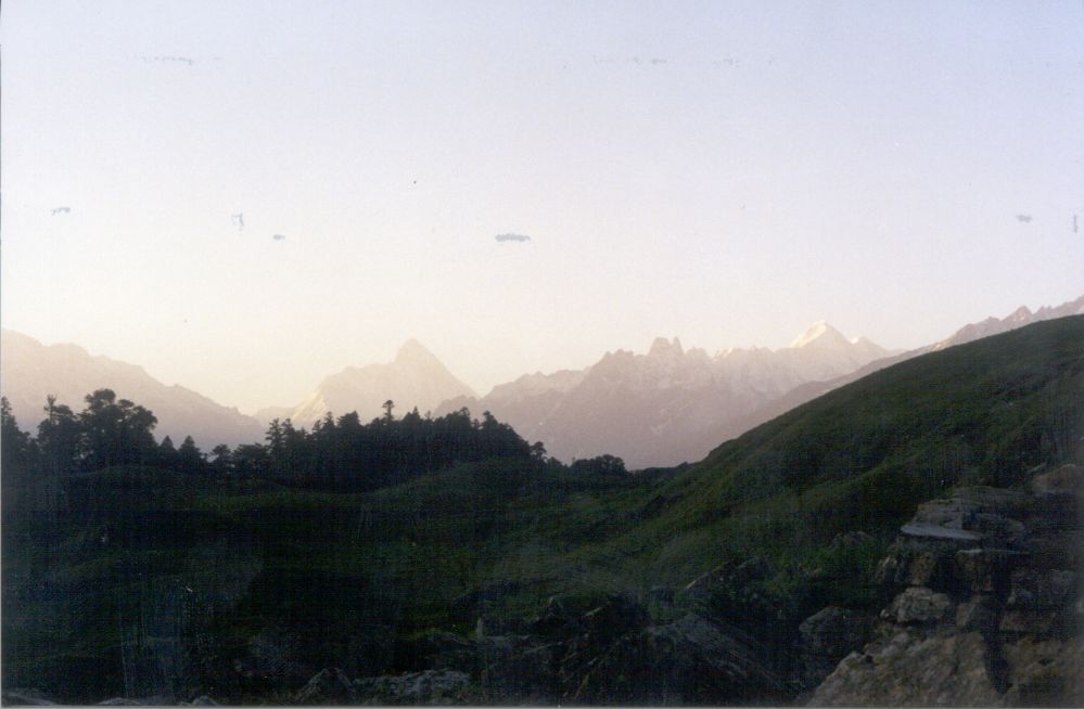
By 4:00 pm we were very near to Gurson Top. We found a good camping site and decided to halt for the night. Our porter prepared soup for us. It was as if we were sitting at the top of the world, surrounded by snow covered Peaks. The wind was strong and it took us some time before we could get our tent up. The chill in the air forced us into our tent early. The night was clear and all the peaks were moonlit. The hot dinner did help in adding calories to our tired and cold bodies.
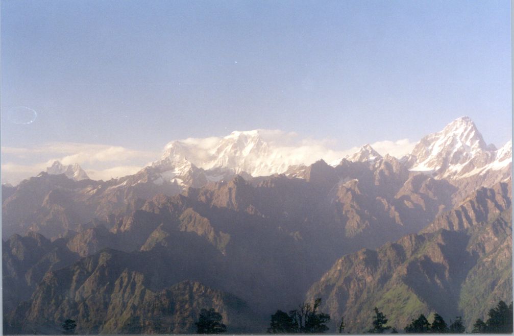
I was the first one to get up at 4:00 am. The view was simply majestic.
 The white moonlit peaks glistening all round me. As the time passed, the
first ray of light fell on Nanda Devi. Slowly one by one all peaks started
changing their color. I could see the Hathi Parbat and also the point where
Kagbhusandi lake is situated. I could also see the ledge on which lies
the Hemkund Lake. And turning towards west I was able to see Chaukhambha
and the other peaks around Kedarnath. It is almost impossible to give words
to that experience and was difficult to catch the mind boggling view in
the camera. Soon others joined me and the porter brought the first cup
of the morning tea for us.
The white moonlit peaks glistening all round me. As the time passed, the
first ray of light fell on Nanda Devi. Slowly one by one all peaks started
changing their color. I could see the Hathi Parbat and also the point where
Kagbhusandi lake is situated. I could also see the ledge on which lies
the Hemkund Lake. And turning towards west I was able to see Chaukhambha
and the other peaks around Kedarnath. It is almost impossible to give words
to that experience and was difficult to catch the mind boggling view in
the camera. Soon others joined me and the porter brought the first cup
of the morning tea for us.
We started early that morning. It was one of the best day of our trip.
Trekking through the famous Gurson meadows with nothing to block the view
of beautiful peaks around. The Dhauli Ganga Valley was there right down
 below. And on the far side was the Nanda Devi Sanctuary.
And in front was the glistening Nanda Devi Peak.
Negotiating the ridge was the tricky task. The trek was few inches wide
at some places with steep fall of hundreds of feet down below. The outward
journey was relatively easier as we were climbing and had to just concentrate
on looking uphill. Once in a while I gathered the strength to look down
and what I saw still sends shivers down my spine. On way back, the guide
decided that going via the ridge might turn out risky as we will be going
down while going back. So he chose the option of scaling the 70-80 degree
slope of the mountain face to reach Gurson Top. I can never forget that
 experience of slowly scaling the steep face of the hill. Those hours when
we were just clinging to the mountain face and maintaining the balance
to stop ourselves from rolling down into the valley down below.
experience of slowly scaling the steep face of the hill. Those hours when
we were just clinging to the mountain face and maintaining the balance
to stop ourselves from rolling down into the valley down below.
By the evening we were back in the forests, few kms above Auli. The rest of our team members joined us and we had a small camp-fire to celebrate the trip. Next morning we started our return journey. We took our night halt at Karnprayag and started for Hardwar the next day. Thus one more exciting trip in Garhwal Himalayas came to an end with the hope that many more will follow.