 |
 |
 |
 |
In summer of 1997, we had gone to Badrinath and Kedarnath. My friend Navdeep, had often talked about a place called Chopta. So we had added Chopta also in our plan. We reached Badrinath after taking a night halt at Rudraprayag. Shri Badrinath temple is dedicated to Lord Vishnu. It is 15 m tall and is built in the form of a cone surrounded by a small cupola comprising gilt ball and spire. To the west is Neelkanth peak (6600 m), the "Queen od Garhwal", presenting an imposing view.
There are number
of places around Badrinath, which are worth visiting. Vyas Gufa, a rock
cave near Mana, 3 kms past Badrinath, is where Ved Vyas supposedly composed
the Mahabharata and Puranic commentaries. Keshav Prayag is the confluence
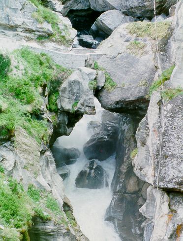
of the rivers Alakhnanda and Saraswati, near Mana. Bhimpul is a huge slab
of stone that is a natural bridge over the Saraswati river from where a
spectacular view of the water thundering through the narrow passage under
the rock may be seen. The rock is believed to have been placed there by
Bhim, the second Pandava.
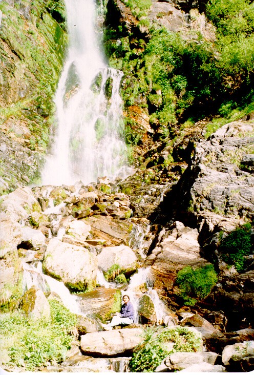
Vasudhara
Falls are 5 kms west of Mana village. The falls which drop a sheer 145
m, are set against a background of snowy peaks, glaciers and rocky heights.
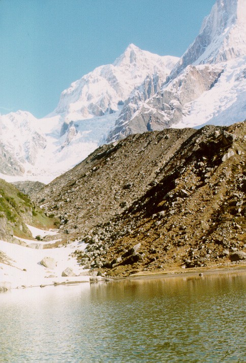
Alkapuri is the source of river Alakhnanda. It is located 15 kms from Badrinath.
The river rises from the glacier snouts of the Bhagirath-Kharak and Satopanth
Glaciers. Satopanth lake at an altitude of 4402 m is a triangular lake
with a circumference of about a kilometer. It is about 25 kms from Badrinath.
The trek is hazardous, an a guide is advisable. For more enterprising,
a trek to Arwa Tal (3980 m) via Mana, Ghastoli and Arwa Nala is rewarding.
We trekked till Vasudhara Falls. Akshat had his first experience of walking
over a glacier.
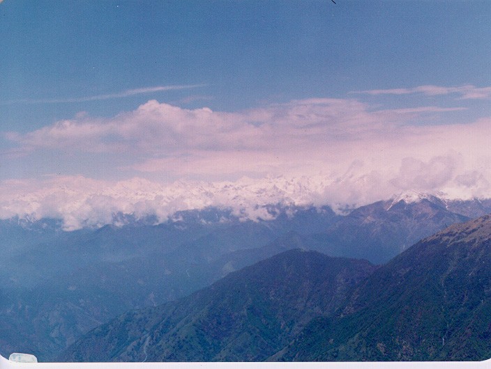
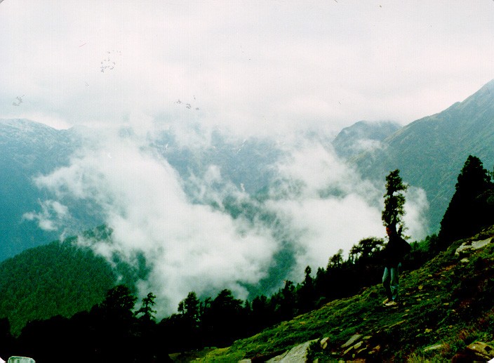
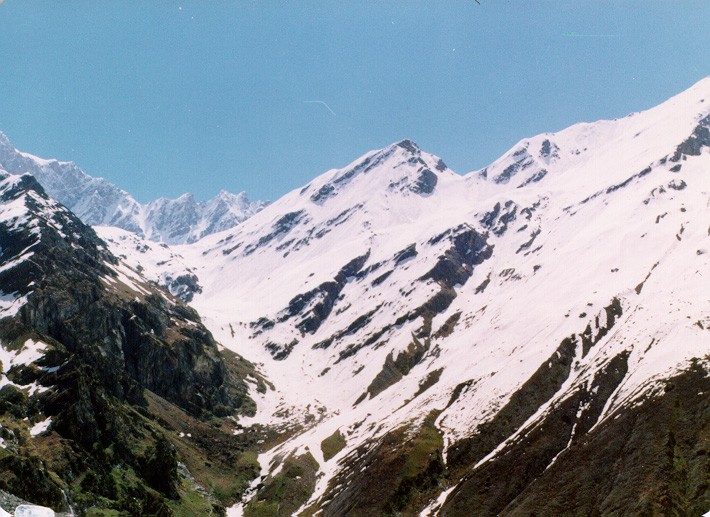
Chopta, situated on the Okhimath-Gopeshwar motor road, is famous for its mountain view. From here one can trek up to Tungnath either by a steeper, 3 kms route or longer but easier 5 kms route. Tungnath is one of the five kedars and is the highest Shiva shrine amongst the Panch Kedars. We climbed the Chandrashilla peak. It can be reached in about an hour's time. This peak provides a rare panoramic view of innumerable snow peaks. The whole range of Himalayas right from Bhagirathi peaks in the west to Trishul in the east are visible from one point. The trek passes through forests of rhododendrons and alpine meadows.
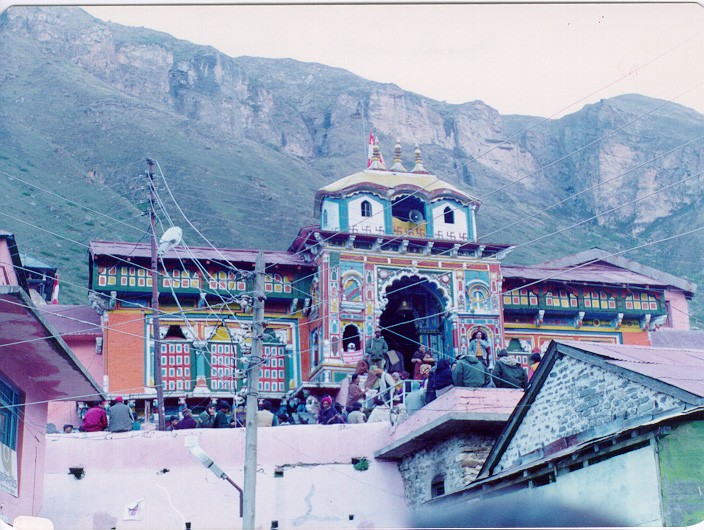
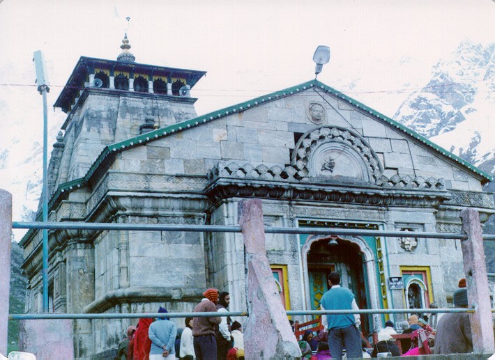
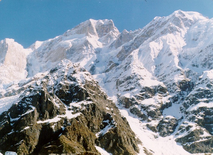
From Chopta, we went to Gaurikund on way to Kedarnath. From there we trekked to Kedarnath. Kedarnath is at an altitude of 3584 m. A magnificent temple was built by the Pandavas at the base of Kedarnath Peak's south-eastern face. The trek starts from Gaurikund and follows the river Mandakini. There are several beautiful waterfalls along the way.
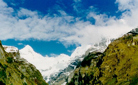
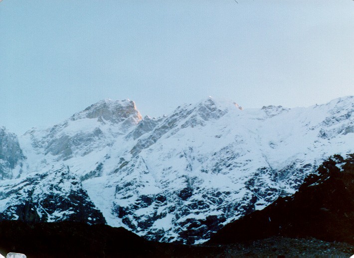
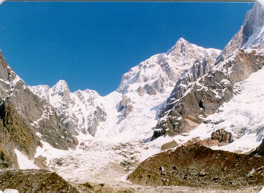
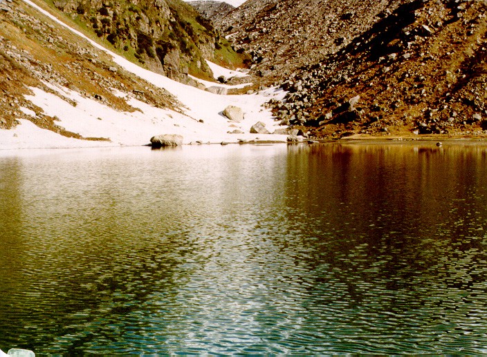
One can trek around Kedarnath. Vasuki Tal is 6 kms from Kedarnath. It is a continuous ascent along a goat track. The view of Chowkhamba peaks and Mandakini Valley is wonderful from here. This lake is 1 km in radius. Another lake Paian Tal is about a km to the northwest.
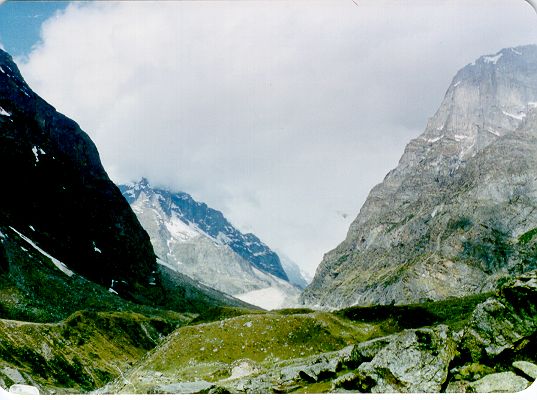
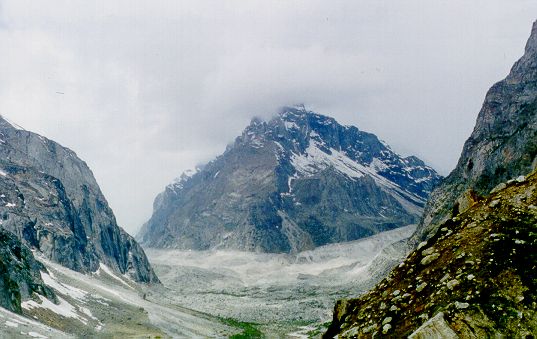
We trekked
to the source of Mandakini, Chowbasa glacier. It is only two kms over moraines.
Lake Chorabari or Chowbasa or Gandhi Sarovar is fed by melting snow from
Chowbasa glacier. Given below are photograph's from our trip.
| |
|
|
|
 |
 |
 |
 |
 |
 |
 |
|
 |
 |
 |