Trekking III: Khatling Glacier
Surrounded by
many named and unnamed peaks, there are
 two very beautiful lakes, Masar Tal and Vasuki Tal, near Kedarnath. To reach
these two lakes one can either go via Kedarnath or through Bhilangana
river valley. In summer of 1995, I joined a group from Institute trekking
club, for Khatling Glacier, Masar Tal and Vasuki Tal trek.
two very beautiful lakes, Masar Tal and Vasuki Tal, near Kedarnath. To reach
these two lakes one can either go via Kedarnath or through Bhilangana
river valley. In summer of 1995, I joined a group from Institute trekking
club, for Khatling Glacier, Masar Tal and Vasuki Tal trek.
This was a relatively difficult trek and required better preparation. We had a month long fitness program in order to prepare our bodies for the strenuous trek. In first week of June, eight of us left Kanpur for our new adventure. We had hired the rucksacks, sleeping bags and tents from Dehradun.
To reach the
 starting point of this trek, Ghuttu, one has to board the bus from Haridwar
or Rishikesh and travel to Tehri. From Tehri bus frequently ply to Ghansyali,
a small town on Tehri-Guptakashi road. Tehri is district headquarters for
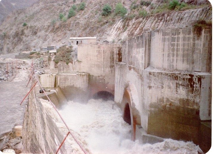
Tehri Garhwal and has been in limelight for controversial Tehri Dam project.
This project has generated lot of opposition from environmentalists because of this area
being prone to earthquakes. The proposed dam is of 288 m in height and
will submerge the old Tehri township and number of small villages on the
starting point of this trek, Ghuttu, one has to board the bus from Haridwar
or Rishikesh and travel to Tehri. From Tehri bus frequently ply to Ghansyali,
a small town on Tehri-Guptakashi road. Tehri is district headquarters for
Tehri Garhwal and has been in limelight for controversial Tehri Dam project.
This project has generated lot of opposition from environmentalists because of this area
being prone to earthquakes. The proposed dam is of 288 m in height and
will submerge the old Tehri township and number of small villages on the
 banks of Bhagirathi and it's tributaries. There is another issue of resettlement. Those who have been shifted to new Tehri, are returning back because of lack
of facilities.
banks of Bhagirathi and it's tributaries. There is another issue of resettlement. Those who have been shifted to new Tehri, are returning back because of lack
of facilities.
From Ghansyali one has to hire Jeep for reaching Ghuttu. Bus service between Ghansyali and Ghuttu being very poor. One can even hire a Jeep for Ghuttu directly from Tehri. Ghansyali is last township where one can pick food items etc.
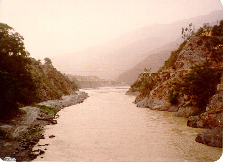
We took our first night halt at Tehri. Reaching Tehri around four in the evening, we visited the site of Tehri Dam. Rest of the evening we passed sitting on the banks of river Bhagirathi. Tehri is at the confluence of river Bhilangana and Bhagirathi. Though, the mountains around are deprived of any tree cover, the Bhagirathi valley near Tehri has it's own scenic beauty. From Tehri bridge the view of Bhagirathi valley is majestic.
Next morning we boarded the bus for Ghansyali. Traveling 30
 kms along Bhilangana river we reached Ghansyali around 10 am. Ghuttu is
another 30 kms from Ghansyali. Road between Ghuttu and Ghansyali was still
to be metaled in 1995. We hired a Jeep for our last stretch of journey
before the trek.
kms along Bhilangana river we reached Ghansyali around 10 am. Ghuttu is
another 30 kms from Ghansyali. Road between Ghuttu and Ghansyali was still
to be metaled in 1995. We hired a Jeep for our last stretch of journey
before the trek.
Ghuttu is a
small village where one can get food and accommodation. One can find guides
and porters in Ghuttu but the right place to look for them is in
Ghansyali. The Ghuttu-MasarTal-VasukiTal-Kedarnath route is not a very
popular trek route hence very few experienced guides are available. But
 guide is must on this route especially if one is trekking in early part
of Summer. We hired one Jaipal Singh Rana to guide us. It was here only that
we came to know about Mayali pass. This is a pass, at the height of 18,600
ft, one has to cross to reach Masar tal. We were ill prepared for trekking
at such an altitude.
guide is must on this route especially if one is trekking in early part
of Summer. We hired one Jaipal Singh Rana to guide us. It was here only that
we came to know about Mayali pass. This is a pass, at the height of 18,600
ft, one has to cross to reach Masar tal. We were ill prepared for trekking
at such an altitude.
Ghuttu is also the starting point of trek route to Kedarnath via Panwali Kantha and Triyugi Narayan. This is more popular route. In older days people use to follow this route for trekking from Gangotri to Kedarnath. It is still used by sanyasis. Though this trek, along ridges and through valleys and dales, is tiring, it is worth it. The splendid panormic view of the Garhwal Himalaya is magnificent and compensates for all the efforts of ascending and descending.
The same evening
we started for Reeh which is 10 kms from Ghuttu. This was to be our first
stop of the trek. For me this trek was going to be a new experience. It
 was for the first time that I was trekking with
such a heterogeneous group. The Border Road Organization has started
making a road from Ghuttu and unmetalled path exists till
a village five kms midway
between Reeh and Ghuttu. Development always has a package attached
to it. We
came across number of wood depots between Ghansyali and
Reeh. Deforestation was in full flow and few realize the
was for the first time that I was trekking with
such a heterogeneous group. The Border Road Organization has started
making a road from Ghuttu and unmetalled path exists till
a village five kms midway
between Reeh and Ghuttu. Development always has a package attached
to it. We
came across number of wood depots between Ghansyali and
Reeh. Deforestation was in full flow and few realize the
consequences of denudation of hills before it is too late.
Initial stretch of the trek is
a gradual ascent. It took us two hours to reach the first village.
Water is a problem for first five kms as there is no stream on this side
of the river and river water is not drinkable. By the time
we started from the village, the rain clouds were beginning to form.
Raincoats are a must in trekking. Afternoon rains are a common phenomenon
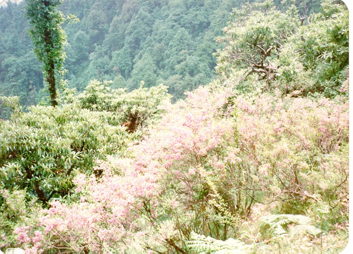
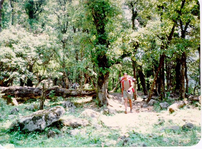 in Garhwal Himalayas. Soon after the first village, the dense tree
cover could be seen. Trekking through the rhododendron, bamboo and
pine forest we reached Reeh around 6 pm, covering the last
one km in heavy downpour. Rest house at Reeh has all type of accommodations
ranging from delux rooms to simple rooms.
Semi-Delux rooms had charges of Rs. 45/- per bed. That day we had
gained 600 m in 10 kms. Reeh is
in Garhwal Himalayas. Soon after the first village, the dense tree
cover could be seen. Trekking through the rhododendron, bamboo and
pine forest we reached Reeh around 6 pm, covering the last
one km in heavy downpour. Rest house at Reeh has all type of accommodations
ranging from delux rooms to simple rooms.
Semi-Delux rooms had charges of Rs. 45/- per bed. That day we had
gained 600 m in 10 kms. Reeh is
a a height of 2132 m.
Next morning
we started our uphill journey to Gangi. The first 5 kms was steep climb,
after which the climb was gradual. From Reeh one route goes to Sahasra Tal,
another beautiful high altitude lake surrounded by snow covered mountains.
Carrying around 16-17 kgs of load in our rucksacks, we made slow
progress to Gangi, trekking along the barren hillside. It was almost midday
when we reached a small village, 5 kms from Reeh. From here onwards
 the climb was gradual. We reached Gangi at around 2 pm. and would
have liked to continue but for the rain. Once again the heavy afternoon
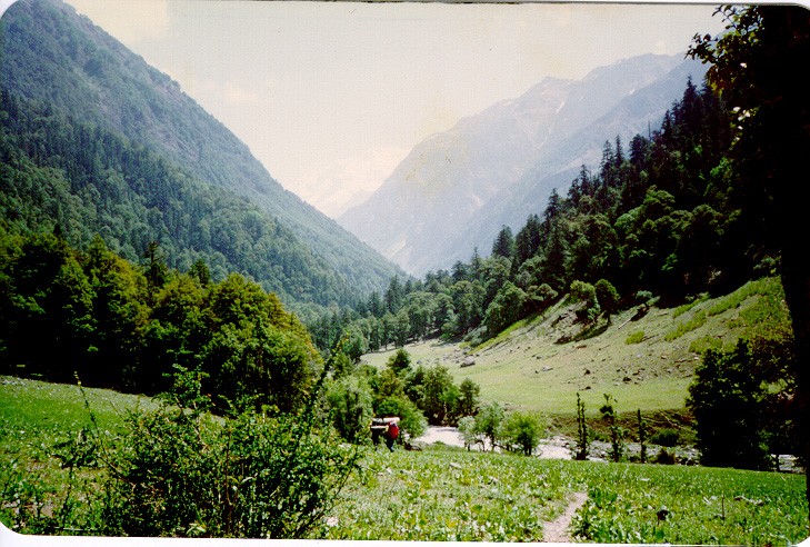
downpour kept us confined to our lodging in Gangi rest house. Gangi
rest house, at an altitude of 2584 m, gives a panoramic view of the beautiful
Bhilangana valley, covered with mist and surrounded by snow covered
mountains.
the climb was gradual. We reached Gangi at around 2 pm. and would
have liked to continue but for the rain. Once again the heavy afternoon
downpour kept us confined to our lodging in Gangi rest house. Gangi
rest house, at an altitude of 2584 m, gives a panoramic view of the beautiful
Bhilangana valley, covered with mist and surrounded by snow covered
mountains.
Our next day's
target was Bhelbheegi, 17 kms from Gangi. The trek route here passes
through dense forests. Initially we trekked downhill to
 the level of the river. We crossed Deokhiri, a beautiful meadow overlooking
the river. It makes a good site for camping. Water is no problem
in this region. Every 200 m one comes across a stream flowing down the
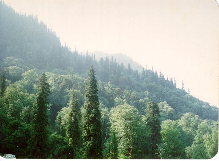
hill side. From here onwards a gradual climb through green forest
of rhododendrons, bamboo and different variety of conifers
the level of the river. We crossed Deokhiri, a beautiful meadow overlooking
the river. It makes a good site for camping. Water is no problem
in this region. Every 200 m one comes across a stream flowing down the
hill side. From here onwards a gradual climb through green forest
of rhododendrons, bamboo and different variety of conifers
took us past kalyani, the last inhabitation on this route.
Trekking another 2 kms, brought us to a wooden bridge over river Bhilangana.
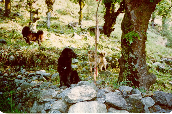
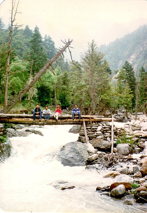 We were warned by the villagers and our guide about the possibility of wildlife
in the forests as the forests on the other side of river were full of
wild animals. Soon after the bridge we came across Gujjar camp.
We were warned by the villagers and our guide about the possibility of wildlife
in the forests as the forests on the other side of river were full of
wild animals. Soon after the bridge we came across Gujjar camp.
Rain clouds
were once again threatening our plan. Nivedita was tired and we
were making a very slow progress. We could only cover a km when the downpour
started. Half the
team went ahead to find a good site for camping while I along with Sandeep
 and Gaurav accompanied Nivedita. Finally when we reached Kharsoli
it was already dark. Others had already settled down.
Kharsoli is a small meadow with a stream
flowing through the middle. This makes it a very good site for camping.
The whole night it rained. In the morning we met another group which was returning
from Sahasra Tal after failing to climb the snow covered mountains
on way to Mayali Pass.
and Gaurav accompanied Nivedita. Finally when we reached Kharsoli
it was already dark. Others had already settled down.
Kharsoli is a small meadow with a stream
flowing through the middle. This makes it a very good site for camping.
The whole night it rained. In the morning we met another group which was returning
from Sahasra Tal after failing to climb the snow covered mountains
on way to Mayali Pass.
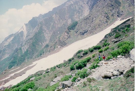
The morning
 brought well needed sunshine allowing us to dry our tents. This
delayed our start. Soon after starting from Kharsoli, we came across
the first glacier. Snow had just
started melting and the streams were still frozen. That day
progress was really slow. Every 100 m we came across a frozen river.
Very few amongst us had any past experience of walking over hard
brought well needed sunshine allowing us to dry our tents. This
delayed our start. Soon after starting from Kharsoli, we came across
the first glacier. Snow had just
started melting and the streams were still frozen. That day
progress was really slow. Every 100 m we came across a frozen river.
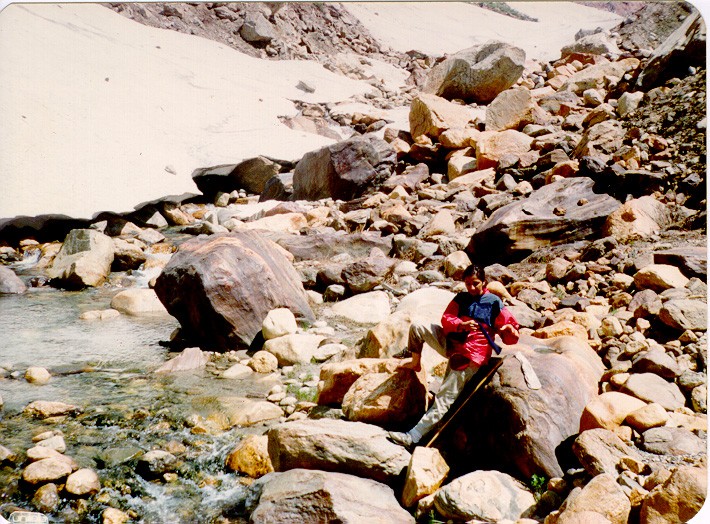
Very few amongst us had any past experience of walking over hard
 snow. We were wearing normal hunter shoes. Tree cover became sparse
as we gained altitude, giving way to rocky terrain full of boulders and
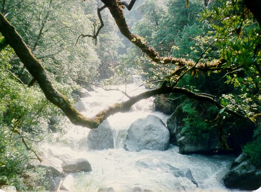
landslides. We were now at an altitude
of 10000 plus ft. Just before Bhelbheege, we came across a huge water
fall. At 3 pm we reached Tamkund and decided to settle down for
the night.
snow. We were wearing normal hunter shoes. Tree cover became sparse
as we gained altitude, giving way to rocky terrain full of boulders and
landslides. We were now at an altitude
of 10000 plus ft. Just before Bhelbheege, we came across a huge water
fall. At 3 pm we reached Tamkund and decided to settle down for
the night.
Tamkund gives
a good view of Chauki and Khating-Phating peak. Chauki is a flat
 meadow at the base of Mayali Pass and is the last halt before one
starts climbing the snow covered mountains to reach Mayali Pass. May-June
are bad months for trekking to Mayali Pass. The streams are frozen and
it requires some experience in mountaineering to finally reach Masar
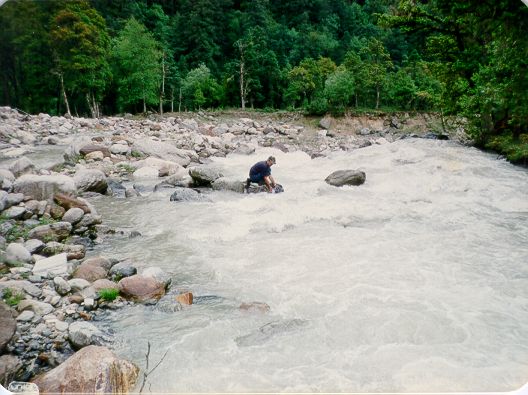
Tal. Most of us were not comfortable walking over snow. To reach
Chauki, one has to go down from Tamkund, cross the river and then trek
along the base of mountain range to reach the flat meadow. There
is no bridge over the river, so the river has to be crossed early in the
meadow at the base of Mayali Pass and is the last halt before one
starts climbing the snow covered mountains to reach Mayali Pass. May-June
are bad months for trekking to Mayali Pass. The streams are frozen and
it requires some experience in mountaineering to finally reach Masar
Tal. Most of us were not comfortable walking over snow. To reach
Chauki, one has to go down from Tamkund, cross the river and then trek
along the base of mountain range to reach the flat meadow. There
is no bridge over the river, so the river has to be crossed early in the
 morning when water level is at it's lowest. Nivedita's health was
getting worse and we decided in favor of returning back.
morning when water level is at it's lowest. Nivedita's health was
getting worse and we decided in favor of returning back.
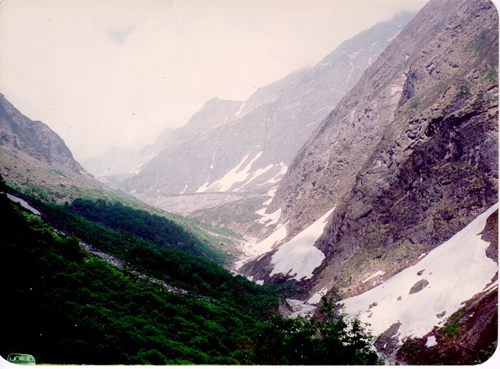
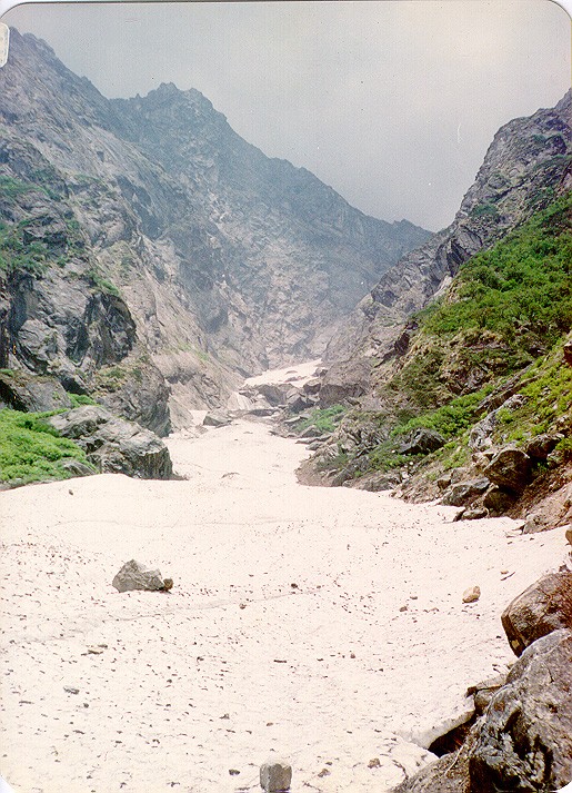
Next morning
we trekked to Khatling Cave from where we got a good view of
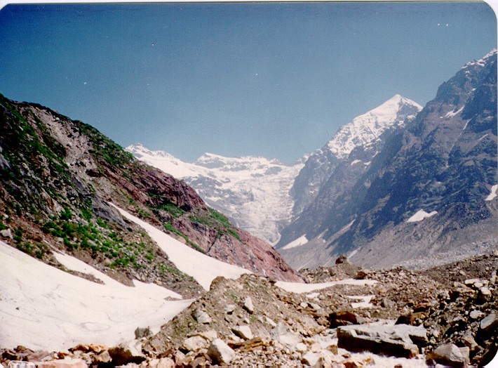 Khatling Glacier. For those with some kind of mountaineering experience,
there is a high altitude route from Khatling Glacier to Gaumukh. Khatling
Cave is 4 kms from Tamkund. From Khatling Cave one gets a good view
of snow covered mountain that one has to negotiate in order to reach Masar
Tal. I was sorry for not being able to fulfill my dream but then
I knew I was under prepared for the task. That night we were back at Kharsoli.
And we were on our way back from one of the most beautiful river valleys
in Garhwal.
BR>
Khatling Glacier. For those with some kind of mountaineering experience,
there is a high altitude route from Khatling Glacier to Gaumukh. Khatling
Cave is 4 kms from Tamkund. From Khatling Cave one gets a good view
of snow covered mountain that one has to negotiate in order to reach Masar
Tal. I was sorry for not being able to fulfill my dream but then
I knew I was under prepared for the task. That night we were back at Kharsoli.
And we were on our way back from one of the most beautiful river valleys
in Garhwal.
BR>
Map of Khatling Glacier Trek