Trekking VI: Khatling Glacier Revisited
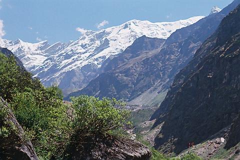
This was my second visit to what I would like to state as one of the most beautiful valley in Garhwal himalayas, the Bhilangana Valley. I was going there after almost a decade, once again with a plan to cross Mayali Pass. It is rated as one of the difficult treks, especially in early season when the snow is more. The best season to cross Mayali Pass is September-October. Mid June is slightly early to attempt Mayali Pass and it requires good preparation. And seven of us had prepared hard for this.
Days before the trek were hectic and preparations almost went upto last minute before boarding the train. From Delhi we reached Hardwar by train and covered the 160 kms distance from Haridwar to Ghuttu on SUVs. When we reached Ghuttu in the late afternoon, guide and our porters were waiting for us and immediately started for Reeh, our first night halt.
There has been little development in the nine years that have elapsed between my two treks. There has been no progress on road connecting Ghansyali with Ghuttu. Only perceivable development in the area is Tehri Dam and it has taken its own toll. The road from Tehri to Ghansyali has deteriorated, thanks to construction activities for the dam. It is barely motorable now. The bridge across Bhagirathi, near Old Tehri Town, is almost submerged in the lake created by the dam. Tehri town itself, had a deserted look waiting to be engulfed by the ever-rising water level of the Tehri Dam.
Reeh is 10 kms from Ghuttu and
 is a gradual
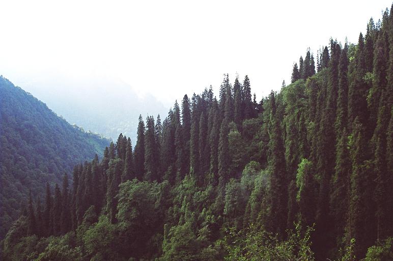
climb along the river Bhilangana. The first half of the route is mostly
barren
with few pine trees here and there. The second half is through the
dense jungle
dominated again by pine trees with rhododendrons and other trees
inter-spread.
One comes across few streams mostly fed by underground water.
is a gradual
climb along the river Bhilangana. The first half of the route is mostly
barren
with few pine trees here and there. The second half is through the
dense jungle
dominated again by pine trees with rhododendrons and other trees
inter-spread.
One comes across few streams mostly fed by underground water.
 It took us four
hours to cover the 10 kms to Reeh and it was almost 9:00 pm when we
reached the
guesthouse at Reeh.
It took us four
hours to cover the 10 kms to Reeh and it was almost 9:00 pm when we
reached the
guesthouse at Reeh.
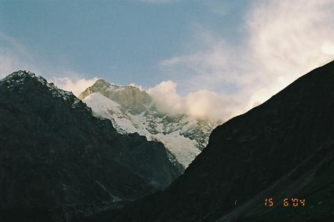
Reeh (2132m)
is a small village with a rest house and few houses. These are perched
on a
ridge, overlooking river Bhilangana. A small glacier-fed stream flows
behind
the resthouse. People here are mostly engaged in agriculture.
Next
morning, we woke up early, repacked our rucksacks and started for the
tough
uphill climb to Gangi. Gangi is 10 kms from Reeh and first half upto
village
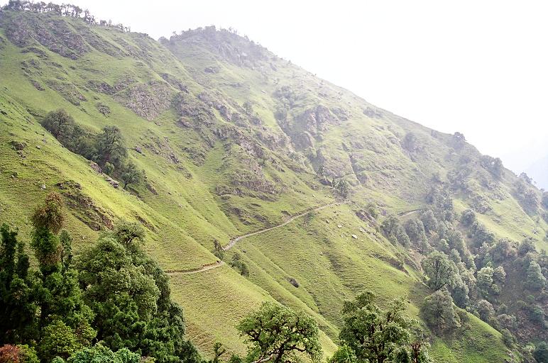 Nallan is tough uphill climb. Especially the initial part and the last
part of
the first five kms are steep. There is no water available before
Nallan, hence water bottles should be filled in Reeh itself. The trek
route is along the ridges with
sloping meadows and few trees, mostly those of rhododendrons. It was a
slow
progress as bodies were yet to get accustomed to the load of rucksack
on the back and the uphill climb.
Nallan is tough uphill climb. Especially the initial part and the last
part of
the first five kms are steep. There is no water available before
Nallan, hence water bottles should be filled in Reeh itself. The trek
route is along the ridges with
sloping meadows and few trees, mostly those of rhododendrons. It was a
slow
progress as bodies were yet to get accustomed to the load of rucksack
on the back and the uphill climb.
After
Nallan, the trek route passes through dense forest, mainly dominated by
rhododendrons. The trek passes number of snow fed streams hence water
is available in abundance from hereon. Trek goes up and down, with cool
breeze squeezing soothing the tired bodies, it is a lovely experience,
 every moment of which should be enjoyed. We reached Gangi around 2:00
pm, just in time to escape the afternoon rains.
every moment of which should be enjoyed. We reached Gangi around 2:00
pm, just in time to escape the afternoon rains.
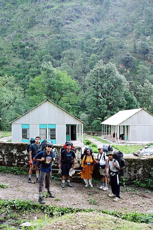
Gangi (2584 m)
has a GMVN rest house where one can stay and cook meals. One has to
make his own arrangement for meals here as there is no canteen. The
rest
house is at the other end of the village and provides a good view of
Talli Top,
Sahasra Tal route from Kalyani. One gets the first glimpse of
snow-covered tops
of Sahasra Tal and Jogin etc. It rained heavily
 in the afternnon, leaving us with no scope for exploring the village.
Early
next morning we started for Kharsoli, 16 kms from Gangi.
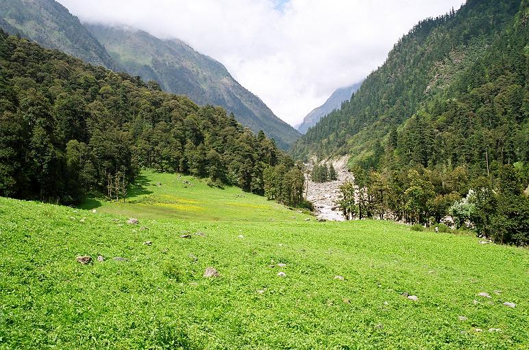
Initial stretch
is mostly downhill. The trek passes through the dense forests
with lush
green meadows in between.
 There are numerous snow-fed streams flowing
down into
the Bhilangana river. There is a small village of 5-6 houses called
Deokhri, some
3 kms from Gangi. Enroute one has to cross two landslide zones, which
become a
bit dangerous after heavy rains. Rain loosens the soil, resulting in
mud
flow and heavy boulders rolling down the steep slope.
There are numerous snow-fed streams flowing
down into
the Bhilangana river. There is a small village of 5-6 houses called
Deokhri, some
3 kms from Gangi. Enroute one has to cross two landslide zones, which
become a
bit dangerous after heavy rains. Rain loosens the soil, resulting in
mud
flow and heavy boulders rolling down the steep slope.
Soon
we crossed Kalyani (2683 m). Earlier, there use to be wooden bridge on
river Bhilangana
near Kalyani. It had been swept away in the floods few years back. By
now we
had descended to the river level. The trek occassionaly cuts through
dense bamboo bushes and is dangerously slippery at number of places. It
almost rains every afternoon in Bhilanagan valley thus making the trek
slippery.
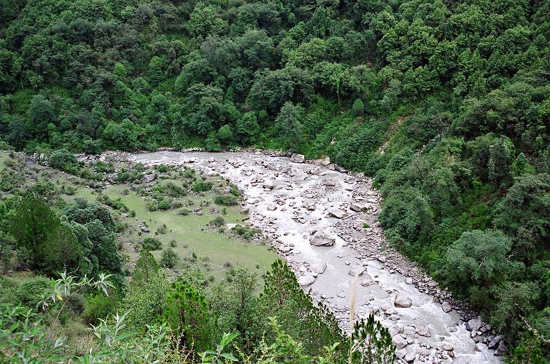
Trek route beyond Kalyani is a gradual climb
through dense forest constituting of Rhododendrons, Juniper, Bamboo
etc. We
took a long break at the banks of a stream that was coming from Sahasra
Tal.
 Keeping our feet in ice-cold water of the stream was freshening.
Chana-gurh,
chocolates, orange drink etc gave us quick energy to continue on the
long journey
to Kharsoli.
Keeping our feet in ice-cold water of the stream was freshening.
Chana-gurh,
chocolates, orange drink etc gave us quick energy to continue on the
long journey
to Kharsoli.
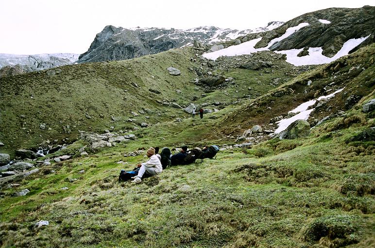
Our next break was at a place called Birodh (2744 m).
Birodh
is a beautiful meadow at a distance of 10 kms from Gangi. In my
previous trip
we had met Gujars here. They no longer visit this area after an
accident few
years back when river changed path and destroyed their camp, taking
some of
their members in its fast flowing water. Birodh is the kind of place
where I would like to retire some day. It is heavenly abode.
It was 3:00 pm when we
reached Kharsoli (2896 m).
Rain God had been kind to us and there was no rain that afternoon.
While the
guide and porters cooked the dinner, we explored the meadow and the
forests
 around. Kharsoli used to be a beautiful meadow earlier. Now it has been
bifurcated by the dried bed of a stream, full of boulders and rocks.
Few years
back, the stream just above the Kharsoli meadow had changed course and
ran
through the middle of the meadow leaving behind the reminder of its
destructive power.
around. Kharsoli used to be a beautiful meadow earlier. Now it has been
bifurcated by the dried bed of a stream, full of boulders and rocks.
Few years
back, the stream just above the Kharsoli meadow had changed course and
ran
through the middle of the meadow leaving behind the reminder of its
destructive power.
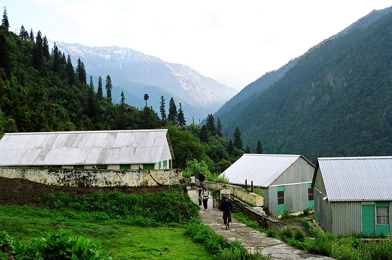
It
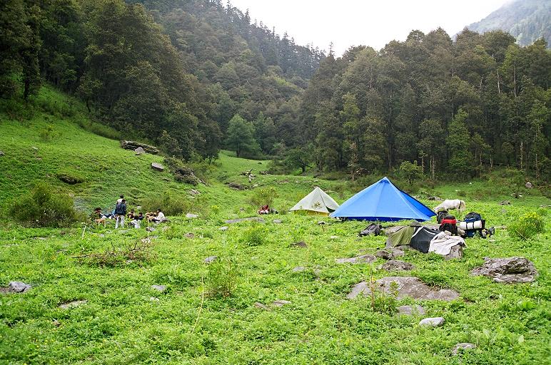 was first camping experience for almost all others. We had an eight men
and a
four men tent. One can use the firewood to cook food. There is a small
stream
at the lower end of the meadow. It provides drinking water.
was first camping experience for almost all others. We had an eight men
and a
four men tent. One can use the firewood to cook food. There is a small
stream
at the lower end of the meadow. It provides drinking water.
 On the
other end of
the meadow, there is a shelter, which can be used for cooking food if
it is
raining.
On the
other end of
the meadow, there is a shelter, which can be used for cooking food if
it is
raining.
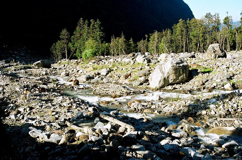
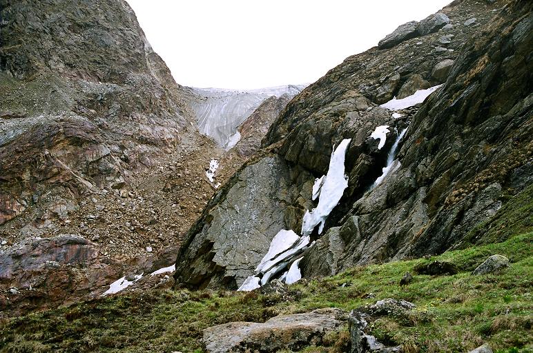
Next
morning we started for Chowki. There are numerous glacier-fed streams
flowing
down on both sides of the river. On my previous visit, most of these
streams
were frozen. I was surprised to find that half of the streams had dried
down
and remaining had very little water. The impact of global warming is
most visible in the area around Khatling glacier.
 Even evironmentalist
rate it as the zone vulnerable to impact of global warming.
Even evironmentalist
rate it as the zone vulnerable to impact of global warming.
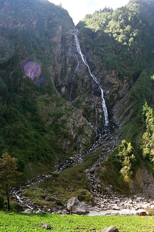
Our
side of the river had number of meadows and good tree cover; the other
side had
towering steep mountains with couple of streams falling down, making
beautiful waterfalls.
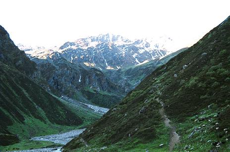
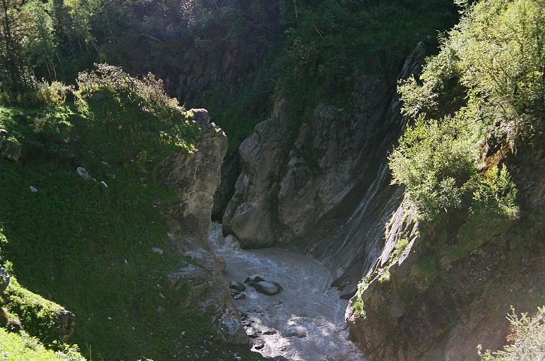 The trek passed through the meadows and the forests, went downhill to reach
the river bed and again climbed uphill as the river cut
deep gorge with towering mountain on one side and high ledge on the other.
As we progressed on our trek, the tree cover gave way to
bushes and then to barren
mountains.
We soon crossed the tree-line and reached a huge land-slide
region. This boulder ridden area is to be negotiated to reach a place
called Tamba-kund.
The trek passed through the meadows and the forests, went downhill to reach
the river bed and again climbed uphill as the river cut
deep gorge with towering mountain on one side and high ledge on the other.
As we progressed on our trek, the tree cover gave way to
bushes and then to barren
mountains.
We soon crossed the tree-line and reached a huge land-slide
region. This boulder ridden area is to be negotiated to reach a place
called Tamba-kund.
 This was our last camping point in my previous trip.
From
Tambakund we trekked another couple of kms before going down to reach
the river
level and cross the river using a makeshift bridge. In the absence of
this makeshift bridge, one has to trek all the way to Khatling Glacier
and then cross the river and return to Chowki.
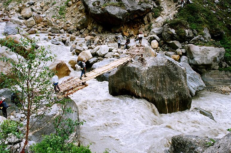 Crossing the bridge was
some experience. It was barely supported on wooden logs connecting two
rocks on
each side of the river. The fast flowing river beneath the shaking
bridge was frightening. The water seemed to be roaring under your feet,
waiting to swallow you in its torrid flow.
Crossing the bridge was
some experience. It was barely supported on wooden logs connecting two
rocks on
each side of the river. The fast flowing river beneath the shaking
bridge was frightening. The water seemed to be roaring under your feet,
waiting to swallow you in its torrid flow.
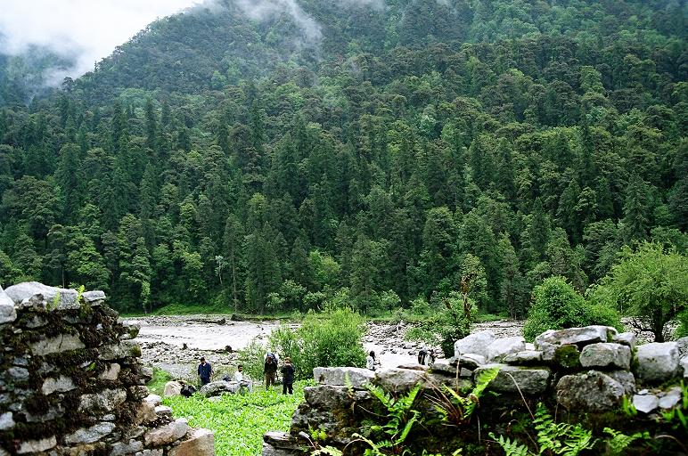
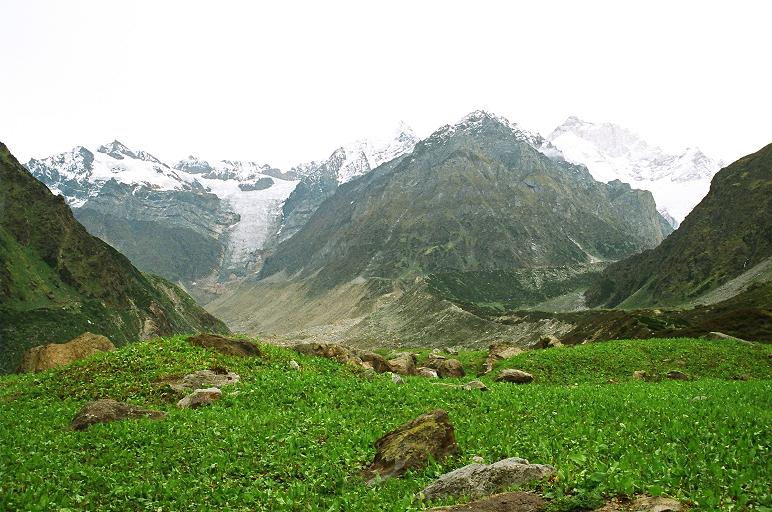
After
 crossing the river, we trekked another one and a half km to reach the
other
edge of the meadow called Chowki. It is overlooking the confluence of
three
rivers. One is Bhilangana which originates from Khatling Glacier. The
second is a
crossing the river, we trekked another one and a half km to reach the
other
edge of the meadow called Chowki. It is overlooking the confluence of
three
rivers. One is Bhilangana which originates from Khatling Glacier. The
second is a
 small river coming from base of Khating-Phating peak and overflows
through a small
water body called Bhim-tal, formed by the moraine from Khatling
Glacier. Third
river was flowing down from the mountains we were to scale on our way
to Mayali
Pass. It is called Doodh-Ganga. We had lot of time to explore the region
and
wanted to go to other side of Doodh-Ganga to reach Bhim Tal, but water
level
had risen and it was difficult to cross the river.
small river coming from base of Khating-Phating peak and overflows
through a small
water body called Bhim-tal, formed by the moraine from Khatling
Glacier. Third
river was flowing down from the mountains we were to scale on our way
to Mayali
Pass. It is called Doodh-Ganga. We had lot of time to explore the region
and
wanted to go to other side of Doodh-Ganga to reach Bhim Tal, but water
level
had risen and it was difficult to cross the river.
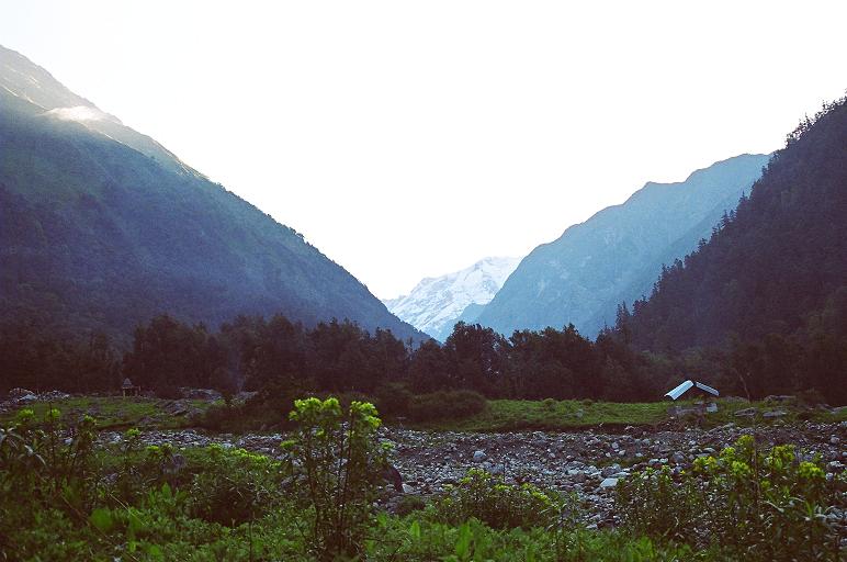
 three rivers flowing through the rocks and moraine. The wildness of the
nature
is something to experience and cannot be worded. It was highly
windy in the valley and there were frequent
drizzles. Once in a while the clouds would give way to the glimpse of
route we
were to follow the next day. While everyone was enjoying the natures
wealth, I had my own worries to handle.
three rivers flowing through the rocks and moraine. The wildness of the
nature
is something to experience and cannot be worded. It was highly
windy in the valley and there were frequent
drizzles. Once in a while the clouds would give way to the glimpse of
route we
were to follow the next day. While everyone was enjoying the natures
wealth, I had my own worries to handle.
 We
were at around 11000 ft and people were complaining
of headache etc. I had to keep all my observatory sensors active, to
catch early any sign of altitude sickness.
We
were at around 11000 ft and people were complaining
of headache etc. I had to keep all my observatory sensors active, to
catch early any sign of altitude sickness.
Next
morning we started our climb towards Masar Tal.
 The trek was uphill
from here onwards. Our guide had planned for the
next camp somewhere midway to Masar Tal. Climb
was steep but distance to cover was not long hence we were moving at
gradual
pace. We could feel the low oxygen in the air and our lungs were
experiencing the stress due to
altitude. Still we were making a good progress. We would aim for a top
and on reaching that top we would
The trek was uphill
from here onwards. Our guide had planned for the
next camp somewhere midway to Masar Tal. Climb
was steep but distance to cover was not long hence we were moving at
gradual
pace. We could feel the low oxygen in the air and our lungs were
experiencing the stress due to
altitude. Still we were making a good progress. We would aim for a top
and on reaching that top we would
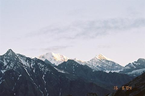 see another and so the climb continued. Every top added to our view of
the peaks around and the Khatling valley. We could see the bluish-green
glacial waters of Bhimtal down
below. We were getting a good view of Doodhganga falling down from the
glaciar
above. As we progressed , we were able to get the top view of Khatling
Glacier. Many more
peaks were now visible as we crossed our planned camping place and
decided to
climb further close to Masartal.
see another and so the climb continued. Every top added to our view of
the peaks around and the Khatling valley. We could see the bluish-green
glacial waters of Bhimtal down
below. We were getting a good view of Doodhganga falling down from the
glaciar
above. As we progressed , we were able to get the top view of Khatling
Glacier. Many more
peaks were now visible as we crossed our planned camping place and
decided to
climb further close to Masartal.
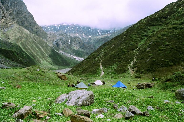
After negotiating a steep landslide zone of small rocks
and
reached our camping site at around 3:00 pm. It had started drizzling
and that made the landslide still more dangerous. Looking down we could
see the straight fall few thousands of feet down below. By the time we
pitched our tents, it was pouring.
 Temperature had gone down and we
simply
huddled into our tents to keep us warm. It had been a tiring uphill
climd and the cold increased our discomfort. The team members were
complaining of headache and one of
the team members looked in slightly bad shape. He was feeling sleepy,
having severe headache and was showing loss of appetite.
Temperature had gone down and we
simply
huddled into our tents to keep us warm. It had been a tiring uphill
climd and the cold increased our discomfort. The team members were
complaining of headache and one of
the team members looked in slightly bad shape. He was feeling sleepy,
having severe headache and was showing loss of appetite.
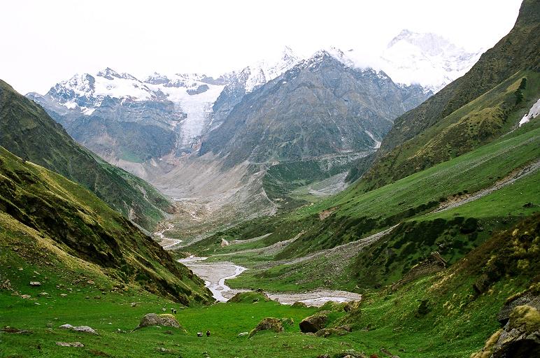
Once the rain
stopped and clouds cleared we came out of the tents to enjoy the good
view of peaks around. We were sitting
very close to a small patch of snow and could see a huge glacier
nearby, hanging at the edge of a top. It was the source of river
Doodh-Ganga. Our guide told us that there are two streams that
come out of this glacier.
 One is Doodh-Ganga which flows west into
Bhilangana river
and another is towards the southeast and flows into Mandakini.
One is Doodh-Ganga which flows west into
Bhilangana river
and another is towards the southeast and flows into Mandakini.
I asked everyone to fix their crampons and test them on snow so that they would know how comfortable they would be walking on snow the next day. Only few members of the team took the trouble of working on their crampons, rest were too tired to force themselves to come out of the warmth of the tent.
Soon
it was dinnertime. While others had a good dinner, Ashish was really
looking sick and vomited whatever little he ate. I realized that Ashish
has to
be taken down immediately as he was showing strong symptoms of high
altitude
sickness. Now came the time to take the decision I had been dreading
all along. A decision which I
avoided taking at Chowki. My initial plan was to decide at Chowki if
some
members of the team have to be sent back. I did ponder over this when I
was at
Chowki but I felt that we all could make it to Kedarnath. Now the
decision was
to either to take the whole team back from here or to divide it into
two. Keeping in consideration, the inexperience of the other members of
the team, I immediately decided to
take the whole team back. I decided that guide and myself will
immediately take Ashish down to Chowki and rest of the team will come
down the next morning.
It was almost dark when our guide, Ashish and I started our journey back to Chowki. The ground was slippery and it was a dangerous downhill journey in dark. We were carrying two high beam torches that made the difference. It took us three hours to reach Chowki and Ashish had completely recovered by the time we reached Chowki.
Next morning I woke up to a beautiful sun-shine outside and the pain inside, of another failed attempt to cross Mayali Pass. But in my heart I knew that I had taken the right decision of coming down. It possibly saved a mishap. Now it was waiting for the remaining team to come down so that we can continue on our return journey to Ghuttu.Return journey was non-eventful. We simply enjoyed the beauty of Bhilangana Valley. We took night halts at Kharsoli, Gangi and Ghuttu before reaching Hardwar. At Gangi, the team enjoyed the village dance festival in the evening.
For me. although it was a dream unfullfilled, but in all it was a great experience with a real good enthusiastic team. In my heart, I still carry the dream of someday re-visiting this beautiful valley in order to cross Mayali Pass.