In summer of 2002, we had gone on a short family holiday to Narkanda, a winter skiing resort in Himachal Pradesh. We ended up going to Sangla valley. We started from Delhi in the evening and reached Punchkula, near Chandigarh, before midnight. After an overnight stay in Punchkula we started for Narkanda early in the morning. This was my second trip on mountain roads. We took the India-Tibet road also known as NH-22. It is a National Highway and is broad and well maintained.
Our plan was to take the breakfast break in Shimla, but seeing the summer crowd in the city, we decided to continue on our way to Narkanda. Shimla, being the capital city of Himachal and one of the most famous hill-stations of North India, is a year round hill-resort and holiday retreat.
We took our breakfast halt in Kufri, 16 kms from Shimla. Kufri is a small hamlet, famous as a best ski resort in Himachal Pradesh. It is also known for its spectacular view of snow-clad far off mountain peaks. It has a helipad too. After a short break, we started for Narkanda.
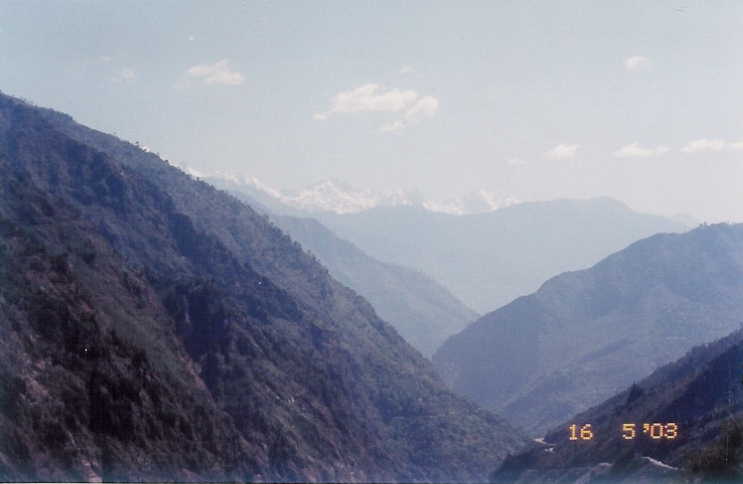
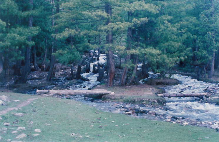
Narkanda, at an altitude of 2708m, is located amidst fragrant pine forest and provides
an awe-inspiring view of snowy peaks. There are number of hotels in Narkanda and
accommodation is not a problem in summers.
 It is located on the ridge between river
Sutlej on the north and river Giri on the south. The sleepy town of Narkanda is an ideal
retreat for a tourist who seeks seclusion in mountains. But having trekked in river valleys
of Garhwal, I found Narkanda to be a bit dry. We changed our holiday plan and decided
to go to Sangla, the next day.
It is located on the ridge between river
Sutlej on the north and river Giri on the south. The sleepy town of Narkanda is an ideal
retreat for a tourist who seeks seclusion in mountains. But having trekked in river valleys
of Garhwal, I found Narkanda to be a bit dry. We changed our holiday plan and decided
to go to Sangla, the next day.
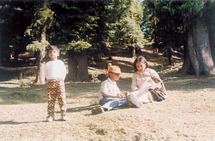
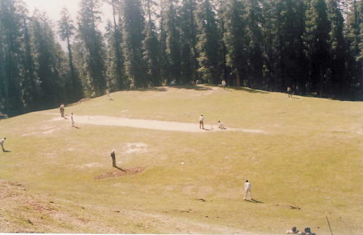
We passed our afternoon strolling leisurely in the forests and meadows around Narkanda and watching a
local cricket match.
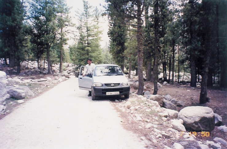
 We made an unsuccessful attempt of taking our car to Hatu peak. The jeepable road
was too narrow for my comfort and I returned after covering few kms. Hatu peak (3300 m) is approximately
8 kms from Narkanda and offers a spectacular view of the snow-clad mountains, the dense forests, green
meadows and the orchards.
We made an unsuccessful attempt of taking our car to Hatu peak. The jeepable road
was too narrow for my comfort and I returned after covering few kms. Hatu peak (3300 m) is approximately
8 kms from Narkanda and offers a spectacular view of the snow-clad mountains, the dense forests, green
meadows and the orchards.
The road to Sangla winds through the dense forest and goes down to reach the altitude of river Sutlej. We
took our breakfast halt at Sainj (33 kms from Narkanda), on the bank of river Sutlej.
 The highway is along
the river from here onwards. By now I had become comfortable with driving in the mountains and with the
broad road and fewer curves, I found myself doing 40-50 kmph.
The highway is along
the river from here onwards. By now I had become comfortable with driving in the mountains and with the
broad road and fewer curves, I found myself doing 40-50 kmph.
We soon crossed Rampur, one of the biggest commercial town of Himachal Pradesh. Earlier it was the capital
of the princely State of Bushahar. It was a major center on the old trade route to Kinnaur, Tibet and Ladakh.
Passing the riverside towns of Nirath, Nogli and Jeori, we reached the Wangtoo bridge, the first crossing on
Sutlej.
 The road in general is good except for few patches, which are highly prone to landslide. We came
across a bad patch near Jeori. Road to Sarahan bifurcates from Jeori. Sarahan is known for its Bhimkali
temple and a good view of Srikhand Mahadeo Peak. It was a major town on old India-Tibet trade route.
The road in general is good except for few patches, which are highly prone to landslide. We came
across a bad patch near Jeori. Road to Sarahan bifurcates from Jeori. Sarahan is known for its Bhimkali
temple and a good view of Srikhand Mahadeo Peak. It was a major town on old India-Tibet trade route.
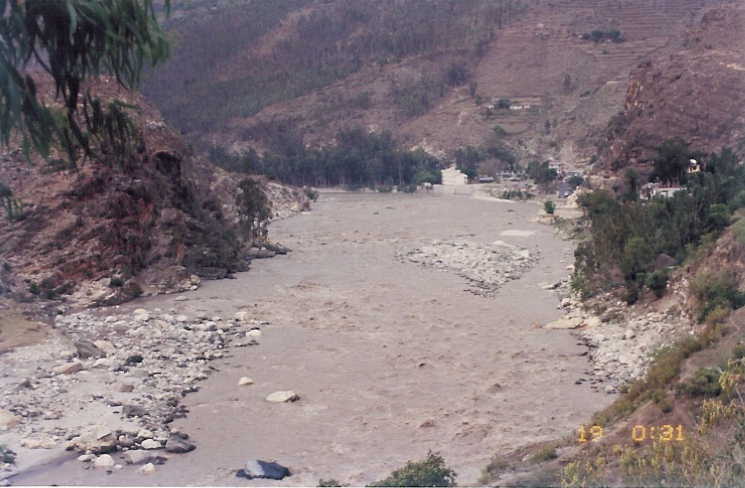
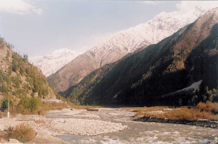
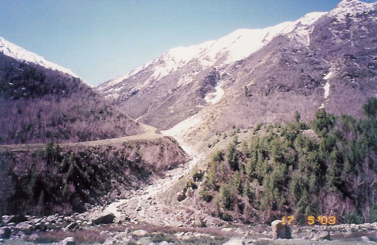
After traveling approximately 150 kms from Narkanda, we reached the cantonment village of Karchham. Here the river Baspa meets river Sutlej. The road to Sangla follows the blue-green water of Baspa along the deep gorge carved by the river, while the NH-22 continues along the course of Sutlej towards Spiti valley. Driving through the 18 kms stretch of steep narrow road was a cliff-hanger experience. I drove slowly, keeping the focus on the road and hoping not to encounter any vehicle coming from the opposite side. We did cross an Army truck and a bus. In both cases I stopped at a broadest point I came across, keeping my car towards the mountain and waited for the vehicle to cross me. The progress was slow and once in a while I stopped to take the breathtaking view of the river flowing down in the deep gorge.
It was a sigh of relief when the narrow valley opened into the wide Sangla Valley, also known as Baspa Valley. Right at the mouth of the valley is the Baspa Hydel Project. In front, amidst the towering mountains with slopes covered with cedar, chilgoza pine and bhojpatra, was the small village of Sangla located on the banks of the Baspa River. On right was the small artificial lake surrounded by the constructions of the Rukti Power Project. With orchards of apple and apricot and river Baspa running through the green-carpeted valley, there was no doubt why Sangla valley, at a height of 2700m, is considered to be one of the prettiest valleys in the entire Himalayas. It was 2:00 pm when we entered the Sangla village.
The Sangla village is small but it has number of small guesthouses and hotels. There is no need to carry any food supplies or sleeping bags etc unless one is planning to camp or trek. The valley was closed to outsiders until 1989, and this is one of the reasons for it remaining untouched by the intrusions of the tourism industry.
We took our lunch and a short break in Sangla village before continuing with our journey ahead to Rakcham.
We had planned to take the night halt in a small village called Rakcham. It is 14 kms from Sangla.
 The
road is partly metalled, party dirt road with streams cutting across at numerous points. It is jeepable
but one has to be careful with city cars having low base. The streams are especially risky to cross in
the afternoon when the water level rises.
The
road is partly metalled, party dirt road with streams cutting across at numerous points. It is jeepable
but one has to be careful with city cars having low base. The streams are especially risky to cross in
the afternoon when the water level rises.
We passed the Banjara camps on our way to Rakcham. Banjara Camp is surrounded by towering mountains on all sides and is set on the banks of the Baspa river that surges through the valley. It is a lovely place to spend a leisurely holiday, taking walks in the forest, trekking to view snow covered peaks, enjoying river crossings and fishing trouts. Sangla Valley is known for its trouts.
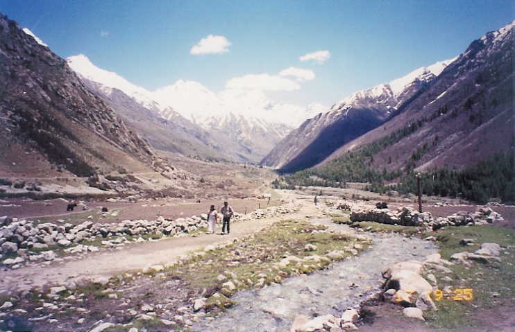
Leaving the Sangla Valley, we had entered into Rupin valley.
 It had started drizzling as we neared Rakcham. Situated at an altitude of 2900m, Rakcham is a small village
with limited accommodation and dining facilities. The village has two guesthouses,
Ganga and Rupin. We decided to stay in Rupin guesthouse because it offered a
good river view.
It had started drizzling as we neared Rakcham. Situated at an altitude of 2900m, Rakcham is a small village
with limited accommodation and dining facilities. The village has two guesthouses,
Ganga and Rupin. We decided to stay in Rupin guesthouse because it offered a
good river view.
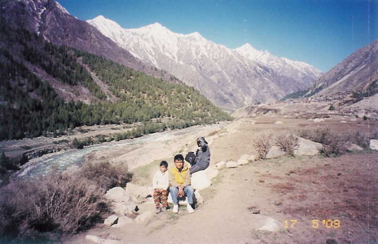
If the Sangla valley is pretty then Rupin is a pastoral wonderland.
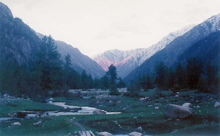 The picturesque little village
of Rakchham, at the lower end of the Rupin valley, is set amidst lofty peaks, glaciers, dense forests,
alpine meadows and cascading streams.
The picturesque little village
of Rakchham, at the lower end of the Rupin valley, is set amidst lofty peaks, glaciers, dense forests,
alpine meadows and cascading streams.
After a short rest, a round of hot noodles and few cups of tea, we were ready for a
long walk to the glacier on the opposite side of the river.
 It was cold and fortunately
we had brought warm clothes. Even in summers, the days are chilly and nights are
cold. The winter months from November to March are bitterly cold.
It was cold and fortunately
we had brought warm clothes. Even in summers, the days are chilly and nights are
cold. The winter months from November to March are bitterly cold.
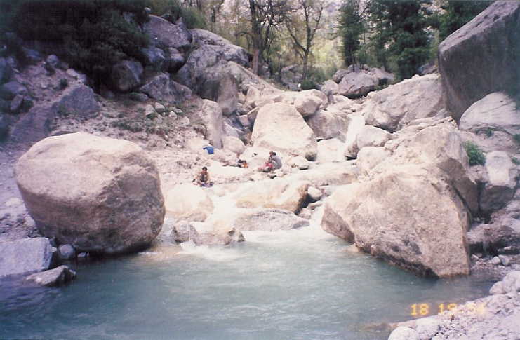
After crossing the old wooden bridge on river Baspa, we came across two locals who were returning
after a days work in the fields.
 The people are simple and hospitable and have retained much of their
original culture. It is an intriguing blend of Hindu and Buddhist religion. The meadow across the river
had numerous streams cutting through it.
We crossed the streams using the log bridges, which required
a bit of balancing in crossing the streams. It was getting dark so we returned from midway.
The people are simple and hospitable and have retained much of their
original culture. It is an intriguing blend of Hindu and Buddhist religion. The meadow across the river
had numerous streams cutting through it.
We crossed the streams using the log bridges, which required
a bit of balancing in crossing the streams. It was getting dark so we returned from midway.
 Next morning, a landslide on Sangla-Karchham road allowed us to extend our vacation by a day, and
we decided to go to Chitkul, 17 kms from Raksham.
We started around 9:00 am after eating a heavy
breakfast and taking packed lunch for the afternoon.
Next morning, a landslide on Sangla-Karchham road allowed us to extend our vacation by a day, and
we decided to go to Chitkul, 17 kms from Raksham.
We started around 9:00 am after eating a heavy
breakfast and taking packed lunch for the afternoon.
 Driving on an un-tarred road going through the
wooded slopes crossing the streams without bridge, we reached Chitkul in an hour.
We took few
breaks enroute, to enjoy the wild nature.
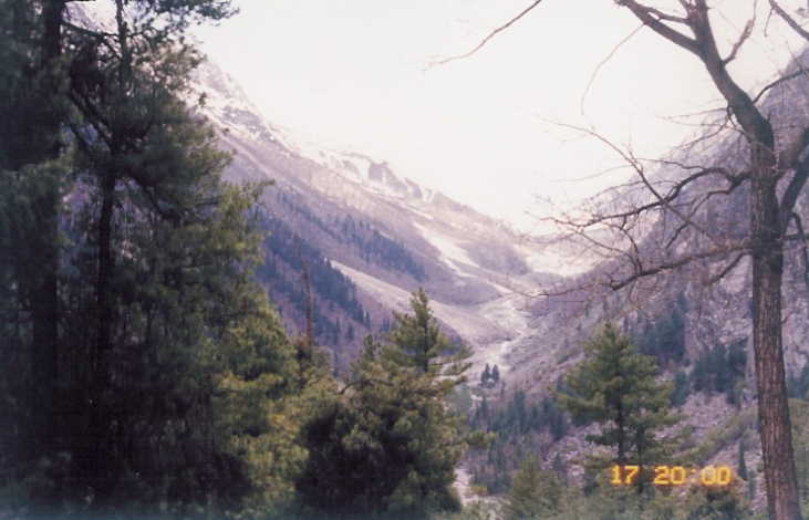
There are numerous camping sites between Raksham and
Chitkul. Chitkul at an altitude of 3450m is the last settlement before Tibet and exhibits distinct signs
of this proximity.
Driving on an un-tarred road going through the
wooded slopes crossing the streams without bridge, we reached Chitkul in an hour.
We took few
breaks enroute, to enjoy the wild nature.
There are numerous camping sites between Raksham and
Chitkul. Chitkul at an altitude of 3450m is the last settlement before Tibet and exhibits distinct signs
of this proximity.
 It has few houses, a PWD rest house and a campsite. It is surrounded by the
snow covered mountains and Tibet border is just 20 kms from here.
It is the base for Kinner-Kailash
pilgrimage and also the starting point for numerous other treks in the region including the one to
Har-Ki-Doon valley in Gharhwal.
It has few houses, a PWD rest house and a campsite. It is surrounded by the
snow covered mountains and Tibet border is just 20 kms from here.
It is the base for Kinner-Kailash
pilgrimage and also the starting point for numerous other treks in the region including the one to
Har-Ki-Doon valley in Gharhwal.
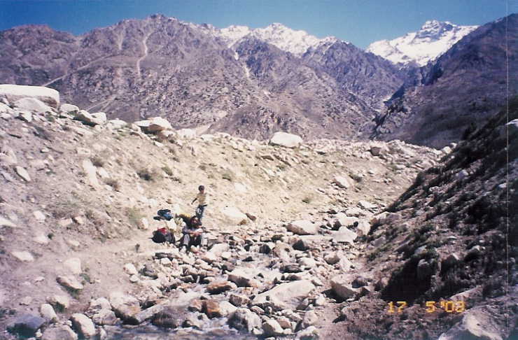
We left our car in Chitkul and trekked 4 kms to Nagasthi, the last Indian outpost before the Tibetan
border.
 No one is allowed to go beyond this point. The area around Chitkul is rocky and starkly
barren. We were almost on the snowline.
No one is allowed to go beyond this point. The area around Chitkul is rocky and starkly
barren. We were almost on the snowline.
 We returned back after spending half an hour with the
locals working in the fields and sharing our lunch with them.
We returned back after spending half an hour with the
locals working in the fields and sharing our lunch with them.
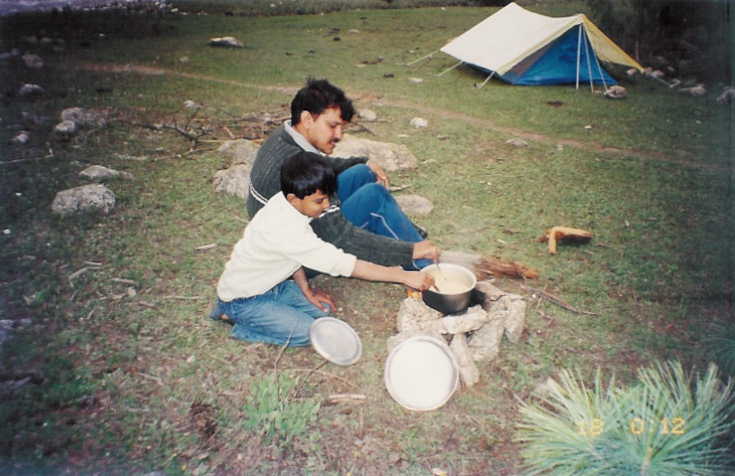
That night, Akshat and I camped in the forest across the river near Raksham. Nandini and Avi
stayed back in the guesthouse. We collected dry woods, made fire and prepared a dinner of Maggie.
It was Akshats first camping experience and he was actively participating in everything including
washing the utensils in ice-cold water of glacial stream.
 The night was windy and bitingly cold.
Akshat was having a mild headache and it worried me a bit.
The night was windy and bitingly cold.
Akshat was having a mild headache and it worried me a bit.
I got up early and prepared tea and noodles for Akshat and myself. Soon Nandini and Avi joined
us with hot breakfast from the guesthouse.
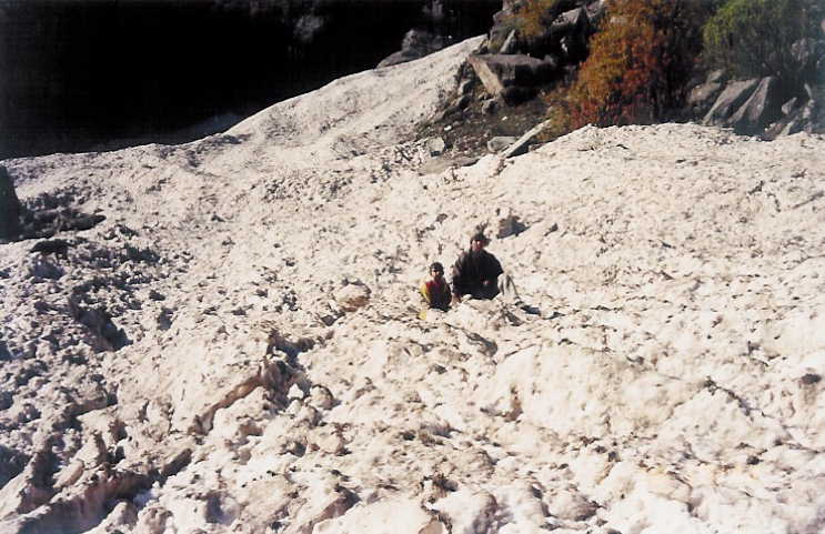 We walked to the nearest glacier, gave a lesson to Akshat
on how to walk on hard ice and returned to pack our tent. Soon we were on our way back to the
hot summers of Delhi. It was a wonderful short holiday in one of the most beautiful valleys I have visited.
We walked to the nearest glacier, gave a lesson to Akshat
on how to walk on hard ice and returned to pack our tent. Soon we were on our way back to the
hot summers of Delhi. It was a wonderful short holiday in one of the most beautiful valleys I have visited.
It was an unplanned trip and I missed visiting the old fort in Kamru village. Would love to come again to this valley, with more time at my disposal, trekking around and exploring the beauty, nature has bestowed on this part of Himalayas. Hoping that the growing tourism doesnt destroy the natural wealth of the Sangla Valley.
The drive back to Karchham was again a nightmare. The narrow road was
getting repaired at many places and at many points the passage was barely sufficient for small cars to
pass through. Life was made still more difficult with busses
and trucks parked on the mountain side, waiting for the road to clear.
 Once we reached NH-22,
the road looked like a 4-lane highway.
Once we reached NH-22,
the road looked like a 4-lane highway.
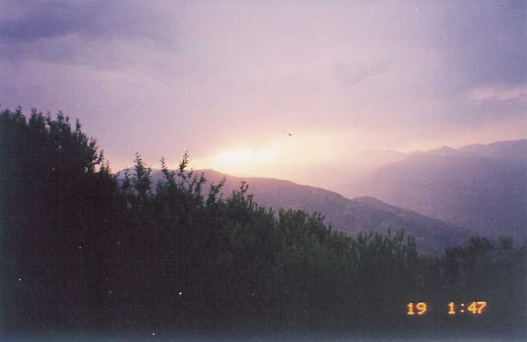
We were on our way to Narkanda. Enjoying the drive along the Sutlej river, we took frequent breaks to enjoy the beauty of the river valley. It was evening, when we left Sutlej valley to curve through the last stretch before Narkanda. Sky changed its color every minute, as Sun slowly went down behind the high ridges. It was almost dark when we parked our car outside our Hotel in Narkanda.
After a good rest we started for Delhi next morning. From Kufri, we took the Chail route. Fagu top, near Kufri, is a crowded place with peak tourist season in summer. Road from Fagu to Chail is not very well maintained but driving through the dense tree cover on both sides is an experience. We were time constrained still I could not avoid the temptation of a morning nap in the shade of the tall green trees, enjoying the quiet of the forest.