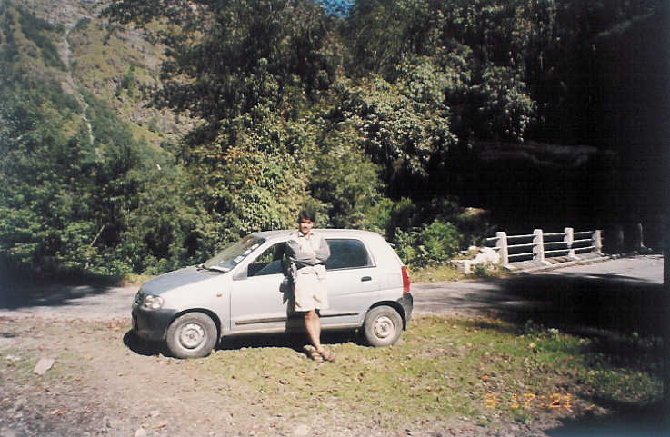
In October of 2003, we started for a short trek to Har-Ki-Doon in Tons river valley, west of Yamunotri valley in Garhwal. The plan was to drive up till Taluka and then spend few days in Tons valley trekking to Har-Ki-Doon and back. Till Netwar, there is a proper road and from Netwar to Taluka the road is jeepable except in rainy season. We were just hoping that the road from Netwar to Taluka would be in motorable shape allowing us to do the Har-Ki-Doon in the limited time we had at our disposal.
Starting from Delhi, we reached Dehradun around lunchtime, crossing the beautiful Rajaji Park enroute. The route to Netwar bifurcates from the Yamunotri route at a point called Nowgaon. There are three routes to Yamunotri. The most popular one is the one from Rishikesh to Dharasu on Gangotri route, and then to Yamunotri via Barkot. The other two start from Dehradun, one via Mussorie and another via Herbertpur. Both the routes are almost same distance and meet at a place called Yamuna Bridge.
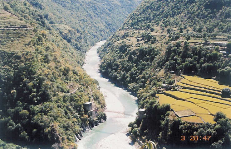
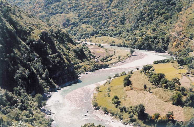
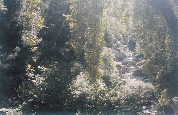
We took the Herbertpur route, avoiding the hilly drive and possibly crowded Mussoorie route. Leaving the bifurcation for Kalsi and thereon to Chakrata, we continued towards Yamunotri on the road to Kata-Pathar. There was no traffic on this route and is one of the reasons for the poorly maintained pot-holed road. The monsoon season had just ended and with a better than average rains, there was running water on the road. The tar was conspicuously missing and the progress was slow. We were traveling on the left bank of Yamuna and the route itself is very beautiful with water gushing from every nook and corner.
After covering around 20 kms, we crossed Yamuna for the first time.
 The nomads
camping on the roadside with their buffaloes populate this part of the valley. This too
added to our slow progress as, it took the buffaloes some time to accept the fact that
the road belonged to others too. Few kilometers before Yamuna Bridge, the road
from Chakrata joined us. Even the quality of road improved and is completely metaled,
except in short stretches where road crossed the path of streams.
The nomads
camping on the roadside with their buffaloes populate this part of the valley. This too
added to our slow progress as, it took the buffaloes some time to accept the fact that
the road belonged to others too. Few kilometers before Yamuna Bridge, the road
from Chakrata joined us. Even the quality of road improved and is completely metaled,
except in short stretches where road crossed the path of streams.
We took a break for lunch at a roadside tea-stall near Yamuna Bridge and continued
on our journey to Netwar.
 After Yamuna Bridge, the road follows the river and is
better maintained. Yamuna valley is the greenest of all the main river valleys in
Garhwal and we took frequent breaks to capture the natures bounty in our eyes.
After Yamuna Bridge, the road follows the river and is
better maintained. Yamuna valley is the greenest of all the main river valleys in
Garhwal and we took frequent breaks to capture the natures bounty in our eyes.
 The
villages enroute, are small and we came across numerous camps of nomads with
their herds of buffaloes.
The
villages enroute, are small and we came across numerous camps of nomads with
their herds of buffaloes.
It was 5:00 pm when we reached Nowgaon, after traveling 54 kms from Yamuna
Bridge, and passing the small towns of Damta, Nainbagh and Kuwa. Situated on the
confluence of rivers Yamuna and Kamal Ganga, Nowgaon is the first major town on
this route.
 The road to Tons valley diverts from here. It was getting dark and Purola
was the destination for the day.
The road to Tons valley diverts from here. It was getting dark and Purola
was the destination for the day.
 Driving on the road, lined with pine and juniper
forests on the two sides, curving along the Kamal-Ganga river, we got the first hint
of why Har-Ki-Doon is so named. Purola, 19 kms from Nowgaon, is a small hilly
town with GMVN rest house at the other end of the town. Normally GMVN rest
houses are ideally located, providing one of the best views, but the one in Purola
is an exception.
Driving on the road, lined with pine and juniper
forests on the two sides, curving along the Kamal-Ganga river, we got the first hint
of why Har-Ki-Doon is so named. Purola, 19 kms from Nowgaon, is a small hilly
town with GMVN rest house at the other end of the town. Normally GMVN rest
houses are ideally located, providing one of the best views, but the one in Purola
is an exception.
In Purola we came to know that the road between Netwar and Taluka has been
destroyed by the cloudburst and we will have to start trekking from Netwar.
 Constrained by the time, we changed our plan and decided to go to Yamunotri
next day. After a hot dinner supplemented with soup, we slept heavily.
Constrained by the time, we changed our plan and decided to go to Yamunotri
next day. After a hot dinner supplemented with soup, we slept heavily.
Next morning, we started early, drove back to Nowgaon and continued on the
Yamunotri route to Barkot, 9 kms from Nowgaon.
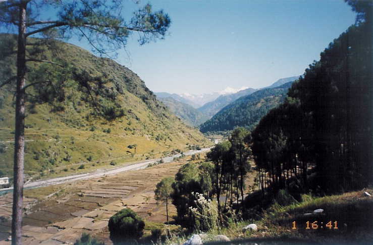 Situated on the bank of river
Yamuna, overlooking a broad valley and providing a panoramic view of
snowcapped peaks around Yamunotri, is the town of Barkot. It is largest town
on this route and has all the facilities available here. We took a breakfast break
at Barkot and then continued on our way to our next destination Hanumanchatti.
Situated on the bank of river
Yamuna, overlooking a broad valley and providing a panoramic view of
snowcapped peaks around Yamunotri, is the town of Barkot. It is largest town
on this route and has all the facilities available here. We took a breakfast break
at Barkot and then continued on our way to our next destination Hanumanchatti.
Route between Barkot and Hanumanchatti is a travelers pleasure.
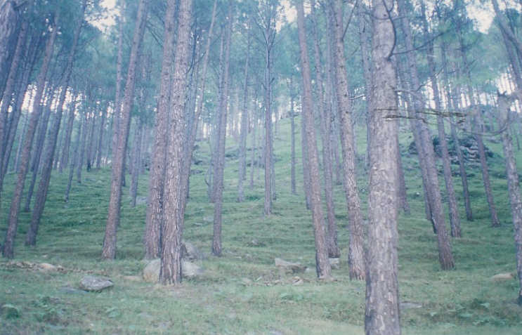
 It passes
through the forest of pine and juniper. Around 15 kms from Barkot we crossed
the twin bridges on Yamuna and passed Kuthnoor. There is a beautiful fall
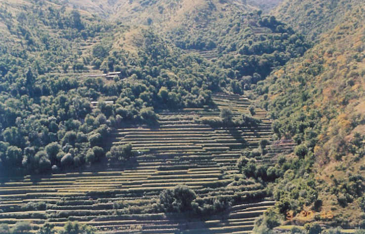
around 1 km after Kuthnoor. The stepped fields on both sides look red with
Ramdana farming.
It passes
through the forest of pine and juniper. Around 15 kms from Barkot we crossed
the twin bridges on Yamuna and passed Kuthnoor. There is a beautiful fall
around 1 km after Kuthnoor. The stepped fields on both sides look red with
Ramdana farming.
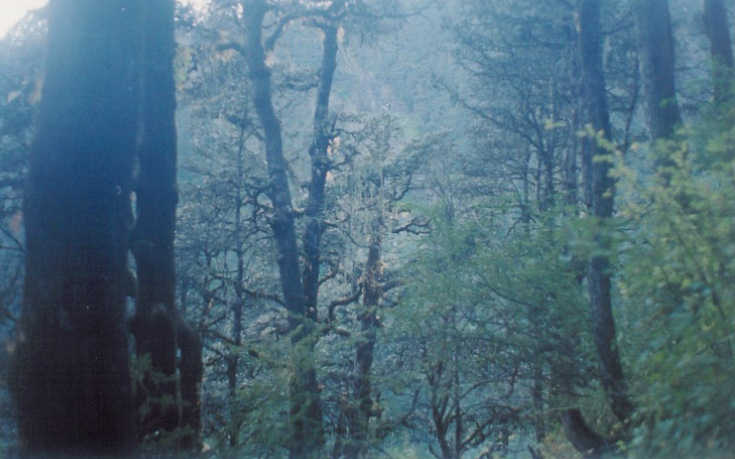
 Driving through the rich wet forest between Kuthnoor and
Sayanachatti, enjoying the occasional glimpse of snowcapped peaks, taking
breaks at the side of small rivulets, we reached Hanumanchatti around noon.
We had covered 36 kms from Barkot.
Driving through the rich wet forest between Kuthnoor and
Sayanachatti, enjoying the occasional glimpse of snowcapped peaks, taking
breaks at the side of small rivulets, we reached Hanumanchatti around noon.
We had covered 36 kms from Barkot.
There is a jeepable road between Hanumanchatti and Janakchatti but we decided
to leave our car in Hanumanchatti and take a Jeep to Janakchatti.
 Parking is a
problem in Hanumanchatti. Janakchatti is 6 kms from Hanumanchatti. It is a
picturesque route through the countryside following the river track. There are
hotels and lodges available in Janakchatti and is the best place to stay. There
are hot water springs here. The valley is broad.
Parking is a
problem in Hanumanchatti. Janakchatti is 6 kms from Hanumanchatti. It is a
picturesque route through the countryside following the river track. There are
hotels and lodges available in Janakchatti and is the best place to stay. There
are hot water springs here. The valley is broad.
We dumped our luggage in a hotel.
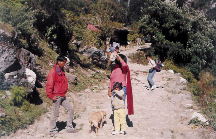 After taking a light lunch, we prepared a
rucksack for the night stay in Yamunotri, hired a guide for Saptrishi Kund and
started for Yamunotri. It is a steep and continuous 6 kms climb to the top, just
wide enough for two horses or a dandi to pass. With horses and dandi crossing
us, we had to be careful with the two kids and a dog.
After taking a light lunch, we prepared a
rucksack for the night stay in Yamunotri, hired a guide for Saptrishi Kund and
started for Yamunotri. It is a steep and continuous 6 kms climb to the top, just
wide enough for two horses or a dandi to pass. With horses and dandi crossing
us, we had to be careful with the two kids and a dog.
 The views are fantastic.
The last half a kilometer is almost vertical. Our progress was slow with little
Avi requiring number of breaks. By the time we reached Yamunotri, it was
almost dark.
The views are fantastic.
The last half a kilometer is almost vertical. Our progress was slow with little
Avi requiring number of breaks. By the time we reached Yamunotri, it was
almost dark.
GMVN Yamunotri is beautifully located at the edge of a dense forest, commanding a good view of the river valley. The food served in the GMVN was simple but tasted good. We went to bed early as night was cold and I had to make an early start for Saptrishi Kund next day.
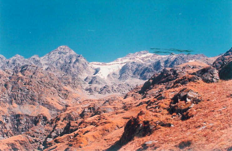
Yamunotri, at a height of 3185m, is primarily a place of religious pilgrimage and is located on the western flank of Bandarpunchh peak. There is a temple dedicated to Goddess Yamuna, the daughter of Surya and sister of Yama. It is said that if you bathe in sacred water, you are spared a painful death. There are many hot water springs around the temple, Surya Kund being the prominent one. The river itself originates from Champasar glacier at an altitude of 4421m.
Next morning my guide and I started for Saptrishi Kund at 5:00 am.
 It was
biting cold and we had packed our breakfast and lunch for the long day ahead.
Saptrishi Kund is a glacial lake on Kalind Parbat, at an altitude of 4421m,
and is said to be the actual source of river Yamuna. The lake is a half km in
diameter and its water is dark blue. It is believed that seven great Rishis -
Kashyap, Atri, Bhardwaj, Vishwamitra, Gautama, Jamdagni and Vashistha,
performed austerities for millions of years here in Satya-yuga. The rare
Brahma-Kamal grows here. The 12 kms trek one way, typically takes 16 hours
to go up and down. One has to deal with high altitude, climbing uphill and
over rock, ice, snow and water. The best time to attempt it is in October when
snow is at its minimum. It is advised that one should get acclimatized by
spending a day or two in Yamunotri. The most important is to get a good guide
who knows the route.
It was
biting cold and we had packed our breakfast and lunch for the long day ahead.
Saptrishi Kund is a glacial lake on Kalind Parbat, at an altitude of 4421m,
and is said to be the actual source of river Yamuna. The lake is a half km in
diameter and its water is dark blue. It is believed that seven great Rishis -
Kashyap, Atri, Bhardwaj, Vishwamitra, Gautama, Jamdagni and Vashistha,
performed austerities for millions of years here in Satya-yuga. The rare
Brahma-Kamal grows here. The 12 kms trek one way, typically takes 16 hours
to go up and down. One has to deal with high altitude, climbing uphill and
over rock, ice, snow and water. The best time to attempt it is in October when
snow is at its minimum. It is advised that one should get acclimatized by
spending a day or two in Yamunotri. The most important is to get a good guide
who knows the route.
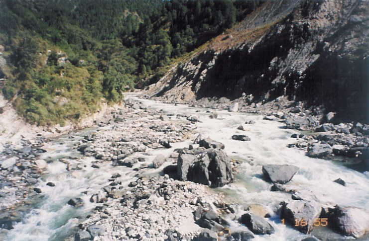
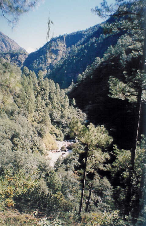
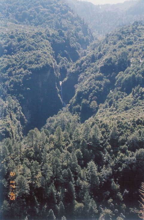
The initial phase of the trek is uphill climb through the dense forest. We were
above the tree line when sun rose in the east.
 There are two waterfalls and we
took our breakfast sitting at the side of one. Climbing up we reached a small
meadow, a place where one can camp for the night. We could see the tops of
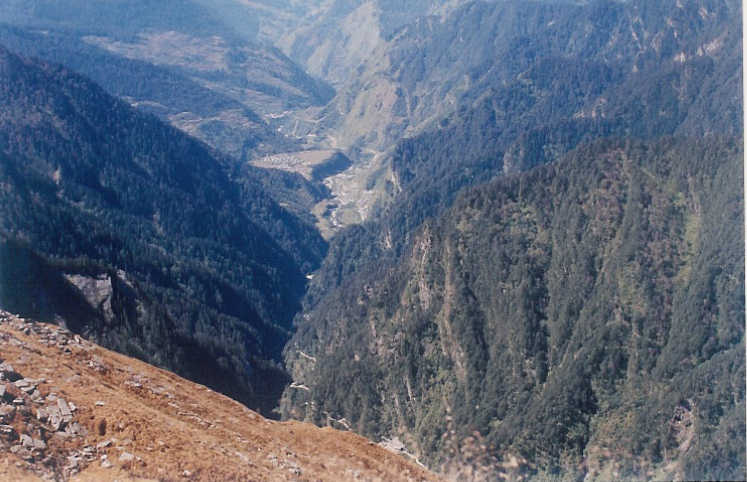
the mountains on both side of the river valley. We could see the high pass
connecting Yamunotri valley with Har-Ki-Doon valley.
Towards our left were
the ridges of DodiTal region covered with dense forests interspersed with
lush green meadows. Soon we were able to get a glimpse of river Yamuna
falling down the edge of Kalind Parbat. I felt the first symptoms of high altitude
sickness.
There are two waterfalls and we
took our breakfast sitting at the side of one. Climbing up we reached a small
meadow, a place where one can camp for the night. We could see the tops of
the mountains on both side of the river valley. We could see the high pass
connecting Yamunotri valley with Har-Ki-Doon valley.
Towards our left were
the ridges of DodiTal region covered with dense forests interspersed with
lush green meadows. Soon we were able to get a glimpse of river Yamuna
falling down the edge of Kalind Parbat. I felt the first symptoms of high altitude
sickness.
 Our progress was getting slow with me requiring frequent breaks.
We covered another 2 kms when I realized that it would be difficult for me to
complete the last 2 kms. We picked up some Brahma-Kamal and started on our
way back. As we lost altitude, I started feeling better and felt completely fit
when we reached Yamunotri.
Our progress was getting slow with me requiring frequent breaks.
We covered another 2 kms when I realized that it would be difficult for me to
complete the last 2 kms. We picked up some Brahma-Kamal and started on our
way back. As we lost altitude, I started feeling better and felt completely fit
when we reached Yamunotri.
 After making a visit to temple and taking a bath in hot water kund, we took a
light lunch and started on our way back to Janakichatti.
After a night halt in a
hotel in Janakichatti, we took off for Hanumanchatti, the next morning.
After making a visit to temple and taking a bath in hot water kund, we took a
light lunch and started on our way back to Janakichatti.
After a night halt in a
hotel in Janakichatti, we took off for Hanumanchatti, the next morning.
 On our
way back, we decided to go slow, enjoying the beauty of Yamuna river valley.
The destination for the day was Mussoorie.
On our
way back, we decided to go slow, enjoying the beauty of Yamuna river valley.
The destination for the day was Mussoorie.
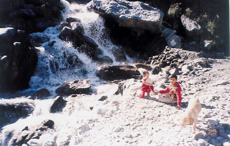
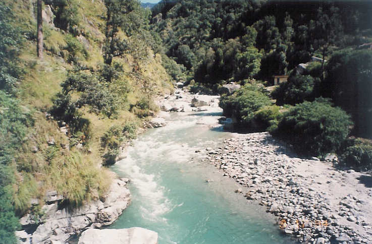
We spent some time on the banks of Yamuna near Gangnani.
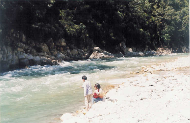 Enjoyed every
moment of our drive back, taking time to capture the natures beauty in our memory.
At Yamuna Bridge we took the road to Mussoorie and reached Kempty Falls
12 kms before Mussoorie. Kempty Falls have a distinction of being the biggest
and prettiest waterfall in the region.
Enjoyed every
moment of our drive back, taking time to capture the natures beauty in our memory.
At Yamuna Bridge we took the road to Mussoorie and reached Kempty Falls
12 kms before Mussoorie. Kempty Falls have a distinction of being the biggest
and prettiest waterfall in the region.
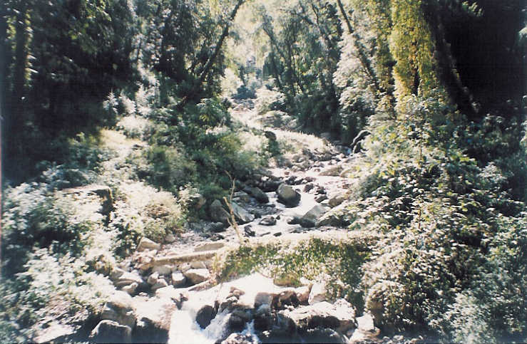
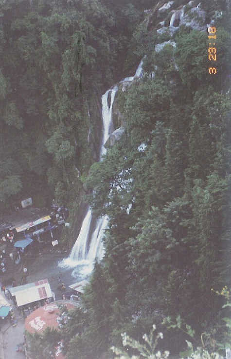 They are located in a beautiful valley
surrounded by high mountains. A bath at the foot of the fall was refreshing. After
a late lunch drove to Mussoorie for the night stay.
They are located in a beautiful valley
surrounded by high mountains. A bath at the foot of the fall was refreshing. After
a late lunch drove to Mussoorie for the night stay.
Mussoorie was crowded as usual but provides a good distant view of snowcapped peaks. Next morning we were on our way back to Delhi after a short and refreshing trip to one of the most beautiful river valleys of Garhwal Himalayas.